Global change has driven a number of environmental changes, such as climate change, changes in water resources, changes in the chemical composition of the atmosphere, ecosystems and ultimately agricultural productivity. Globalisation and adaptation to changing environmental conditions have led to drastic changes in agricultural economies. Finding efficient and sustainable solutions to adapt to the effects of global change is one of the most important challenges of the 21st century. Digitalisation in agriculture plays a crucial role for farmers in this context. On the one hand, it offers the opportunity to optimize and automate processes, but on the other hand, it also poses the greatest challenges for farmers in terms of how to deal with a wide range of data sources and techniques.
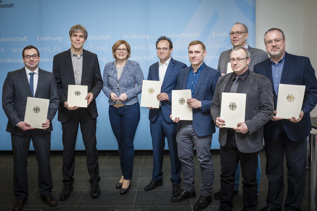
With the handover of funding decisions at the Federal Ministry of Food and Agriculture (BMEL) by Julia Klöckner on March 9, 14 experimental fields will be launched, which will deal with the topic of digitisation in agriculture in various application areas.
The aim of the three-year initiative is to establish digital test fields as innovation drivers. Furthermore, fields of activity in agriculture are to be made more sustainable and attractive. an important goal is to support recommendations for action on digital information flows.
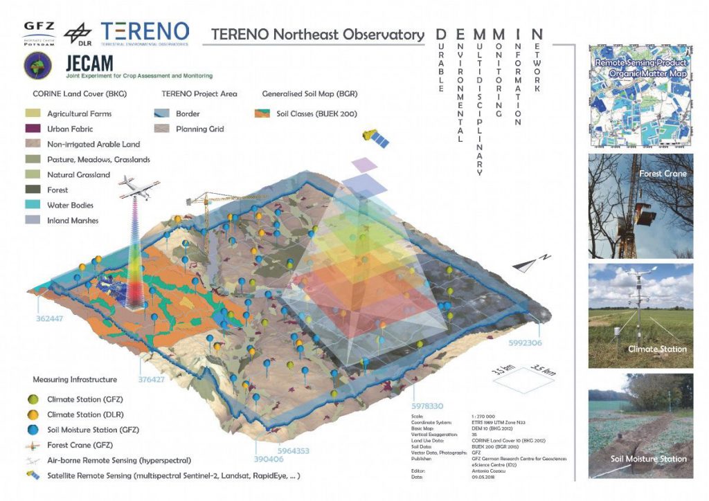
The diagram shows an overview of the “Durable Environmental Multidisciplinary Monitoring Information Network” (DEMMIN), which is operated in the Demmin region of northern Germany by the German Aerospace Center (DLR) and the Geoforschungszentrum Potsdam (GFZ) (source: GFZ 2020).
The Remote Sensing Chair in cooperation with the German Aerospace Center (DLR) and the German Aerospace Center (DLR) at the University of Würzburg is a partner in the experimental field coordinated by the Geoforschungszentrum (GFZ) on the “Use of Remote Sensing Technologies for Digitization in Crop Production”. Under the acronym “AgriSens_DEMMIN_4.0”, the project team, consisting of the Universities of Halle, Jena and Würzburg, the GFZ, the Earth Observation Centre of the DLR, but also the German Weather Service, the Julius Kühn Institute and the Neubrandenburg University of Applied Sciences, is working on concrete applications in agriculture where Earth observation technologies can be used in a practice-relevant manner.
Agriculture is currently facing far-reaching challenges. Progressive climate change, water protection requirements, e.g. the EU Fertiliser Regulation, resistance management in plant protection and nutrient management must be brought into line with the demand for high productivity in the quantity and quality of food and raw materials. Digitalisation can be part of solutions to maintain resource-conserving plant production. At present, farmers are still hesitant to implement digital approaches in practice on a large scale. The experience of more than 20 years of precision farming did not show the expected effects. The complexity of the applications also increases with the number of parameters to be considered and the technology used. Furthermore, it is important for the agricultural entrepreneur to assess the sustainability of an investment in technology and know-how. Agricultural practice requires simple systems to capture the already complex interrelationships of production in the natural environment on a large scale and to generate decisions from these.
The aim is to identify practical applications for the use of remote sensing data, i.e. satellite and UAV-supported systems for concrete questions of crop production, to further and newly develop methods against the background of previous experience and to make this knowledge available to the farmer in particular, but also to anyone interested in general in an uncomplicated way.
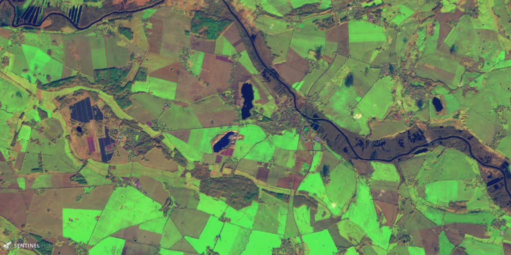
The project partners at the Chair of Remote Sensing at the University of Würzburg will ensure the integration of analysis-ready remote sensing data in this experimental field and thus act as a link between practical users such as farmers, consultants, scientists and the IT specialists at the computer centres. After all, several terrabytes of satellite data are sent from space to earth every day. An example can be seen in the satellite image of the European Copernicus satellite system Sentinel-2, which was taken above the experimental field near Demmin on 8 February 2020.
As in all other fields of application in the digitalised world, it is first necessary to bring a system, an infrastructure and an automation into the large data volumes of earth observation, in order to extract in a further step the really relevant information for agricultural practice.