Henrike Schulte to Bühne handed in her M.Sc. thesis “Quantifying land cover change using remote sensing data in a transboundary protected area” supervised by Nathalie Pettorelli (ZSL) and me. From the abstract: Biodiversity is declining at unprecedented rates as a result of global environmental change, threatening ecosystem stability and resilience, on which human well-being ultimately depends. Transboundary cooperation is being promoted as an effective way to conserve biodiversity that straddles national borders. However, monitoring the ecological outcomes of these large-scale endeavours is challenging, and as a result, the factors and processes likely to shape their effectiveness remain poorly identified and understood. To address this knowledge gap, this thesis quantified loss and fragmentation of natural vegetation across the W-Arly-Pendjari transboundary protected area complex, a key biodiversity hotspot in West Africa. Land cover maps for 2000, 2006 and 2013 were generated by combining open source optical remote sensing data with spectral change analyses and supervised classification algorithms to quantify loss and fragmentation of natural vegetation as a result of agricultural expansion. There was widespread agricultural expansion outside protected areas between 2000 and 2013, whereas expansion was limited inside protected areas. Additionally, natural vegetation was less fragmented inside than outside protected areas. Protected areas with high protection status appeared considerably more effective at 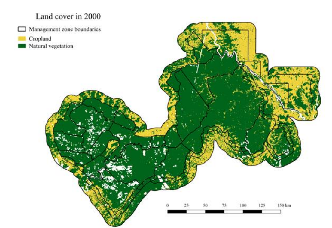 preventing land conversion, and had less fragmented natural vegetation, than other protected areas. There were marked differences in cropland expansion rates between countries, which might be linked to differences in rural population growth. Altogether, these results indicate that transboundary protected areas can be relatively successful at reducing human pressure on biodiversity. However, there can be considerable spatial heterogeneity in anthropogenic pressure across transboundary protected area complexes, which highlights the need for more comprehensive assessments of this mode of biodiversity protection; these assessments could capitalise on the current availability of remote sensing information.

International Staff Week at PSL University in Paris
Within the ERASMUS+ staff mobility program that the University of Würzburg offers its employees, our administrative assistant Sabine Oppmann had the chance to be part of the International Staff Week at PSL Université in Paris to exchange and network with...