Msc Defense by Katrin Wernicke

Msc Defense by Katrin Wernicke

June 30, 2023

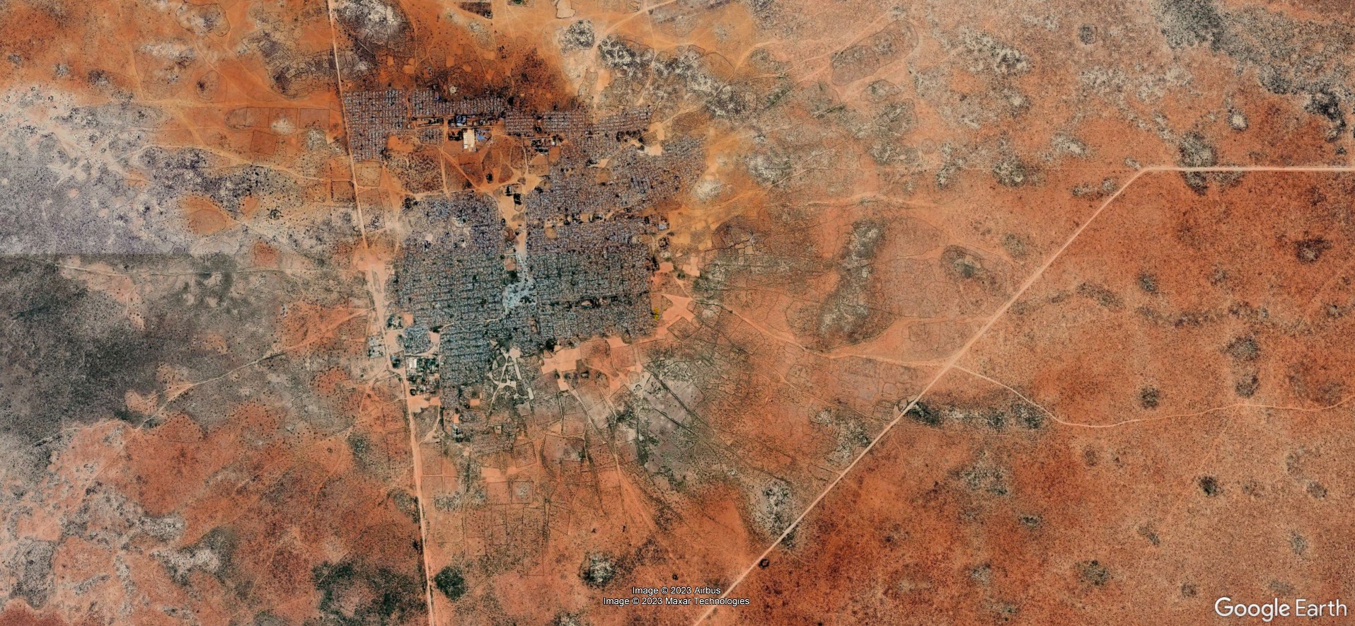
On Tuesday, July 18 at 10 a.m. Katrin Wernicke will present her MSc Thesis “Deep Learning for Refugee Camps – Mapping Settlement Extents with Sentinel-2 Imagery and Semantic Segmentation”

From the abstract:
The number of people forced to flee their homes has more than doubled in the last decade, with over 103 million displaced people by mid-2022. Many seek shelter in refugee camps and informal settlements, which were originally built as temporary facilities. Remote sensing and Deep Learning serve as independent tools for monitoring camps in addition to localised in-situ data. However, research shows an underrepresentation of refugee camps in satellite-based settlement products. This work assessed the applicability of six Deep Learning (DL) models for mapping refugee settlement extents worldwide using semantic segmentation of Sentinel-2 satellite imagery. Two DL architectures, U-Net and FPN, were trained with the encoders EfficientNet-B0, MobileNet-V2, and ResNet-18, and their results were assessed in a comparative analysis. Furthermore, the model accuracies across space and among different morphological structures were evaluated. The results showed that all models faced significant challenges in accurately mapping the settlement extents, although to different degrees. However, some models were successful in localising the camps but overestimated the extents. The analysis revealed that the accuracies varied among camps, and regional clusters of similar accuracies were observed. It is discussed that refugee camps are heterogeneous and complex settlement types which are difficult to delineate in space based on their spatial appearance alone and inconsistent morphological structures. The work highlights the complexity of mapping refugee settlements in a large-scale approach and emphasizes the consideration of morphological differences among camps in image analysis tasks. The findings of this work serve as a foundation for future research on mapping refugee settlement extents with remote sensing for humanitarian aid.

1st supervisor: Prof. Dr. Hannes Taubenböck

2nd supervisor: Jakob Schwalb-Willmann

you may also like:

Our research site and project covered by BR

Our research site and project covered by BR

The University forest at Sailershausen is a unique forest owned by the University of Wuerzburg. It comes with a high diversity of trees and most important is part of various research projects. We conducted various UAS/UAV/drone flights with Lidar, multispectral and...

Meeting of the FluBig Project Team

Meeting of the FluBig Project Team

During the last two days, the team of the FluBig project (remote-sensing.org/new-dfg-project-on-fluvial-research/) met at the EORC for discussing the ongoing work on fluvial biogeomorphology. After returning from a successful field expedition to Kyrgyzstan a couple of...

‘Super Test Site Würzburg’ project meeting

‘Super Test Site Würzburg’ project meeting

After the successful "Super Test Site Würzburg" measurement campaign in June (please see here: https://remote-sensing.org/super-test-site-wurzburg-from-the-idea-to-realization/ ), the core team from the University of Würzburg, the Karlsruhe Institute of Technology,...

EORC Talk: Geolingual Studies: A New Research Direction

EORC Talk: Geolingual Studies: A New Research Direction

On July 19th, Lisa Lehnen and Richard Lemoine Rodríguez, two postdoctoral researchers of the Geolingual Studies project, gave an inspiring presentation at the EORC talk series.   In the talk titled "Geolingual Studies – a new research direction", they...

EO support for UrbanPArt field work

EO support for UrbanPArt field work

From May to September, Karla Wenner, a PhD student at the Juniorprofessorship for Applied Biodiversity Science, will be sampling urban green spaces and semi-natural grasslands in Würzburg as part of the UrbanPArt project. Our cargo bikes support the research project...

Cinematic drone shots

Cinematic drone shots

We spend quite some time in the field conducting field work, from lidar measurements to vegetation samples in order to correlate it with remote sensing data to answer various research questions concerning global change. Field work is always a 24/7 work load and...