new GRASS extension: spatial pattern analysis

new GRASS extension: spatial pattern analysis

June 1, 2017

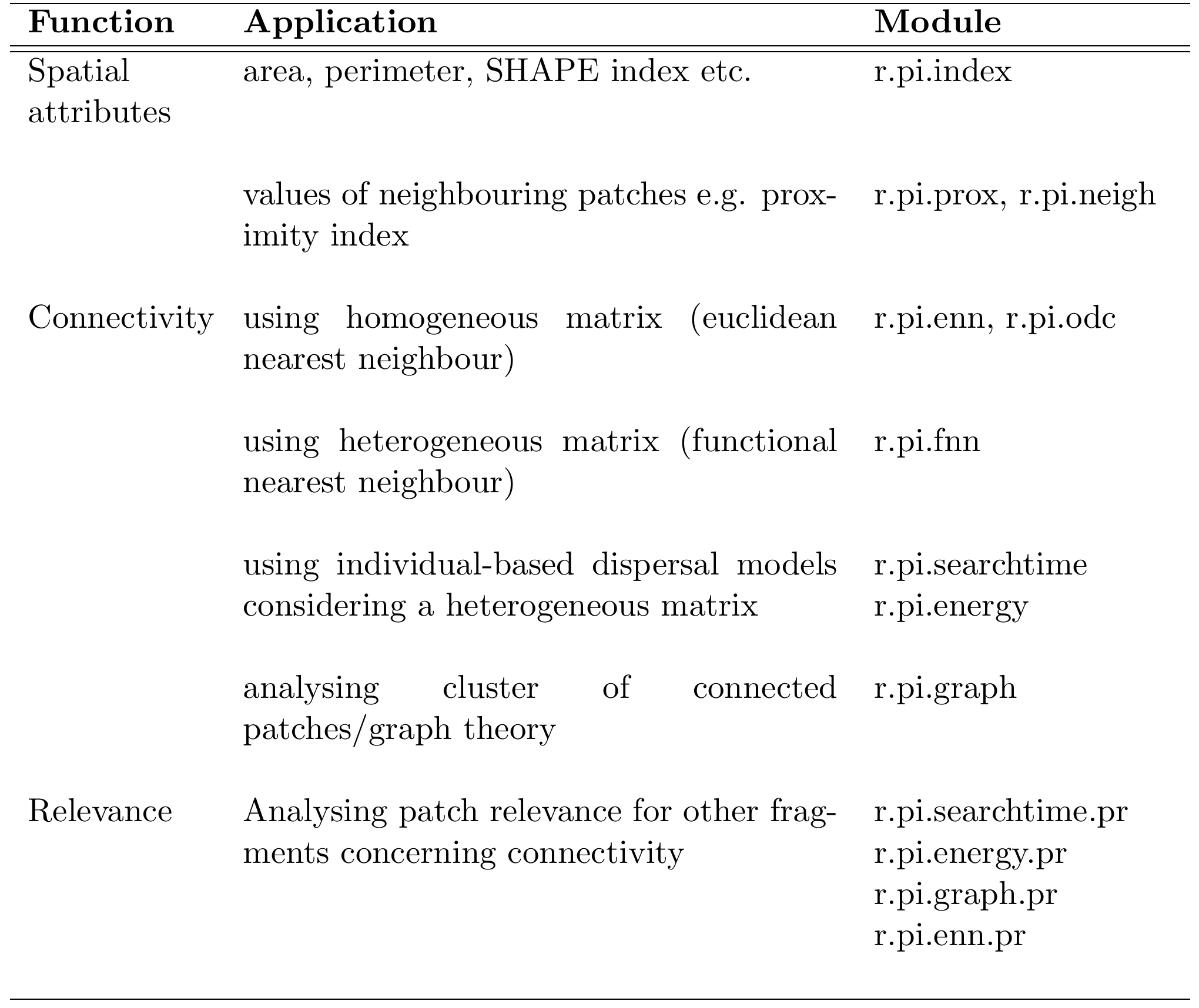
The r.pi GRASS extension is now published and available through the GRASS extension repository. It provides a range of functionality and allows to easily analyze spatial patch attributes in GRASS. Patches are expected to be raster objects derived from remote sensing data and their spatial characteristics is written into a new spatial file for further analysis.

The list of functions outlined in our recent publication in MEE can be seen here. More functions are available in the r.pi package but not specifically mentioned.

you may also like:

EcoGlob interdisciplinary research with Univ. Bayreuth

EcoGlob interdisciplinary research with Univ. Bayreuth

In the last years our EcoGlob team at the Earth Observation research cluster established various new cooperation with colleagues from the University of Bayreuth as well as the University of Würzburg. One of these numerous activities was the UAS/UAS/drone based...

What it takes to record a forest for an entire year: Insights into one out of many days flying drones in the University Forest

What it takes to record a forest for an entire year: Insights into one out of many days flying drones in the University Forest

This week, EOR Cluster staff carried out a routine flight mission in the University Forest: As every second week, the entire 200 ha were imaged with a multispectral sensor on a Wingtra fixed wing aircraft. Additionally, the mission was augmented by LIDAR on an M300 multicopter (as every month). Initially delayed by rainy weather, the crew managed to acquire high quality data, which helps monitoring the ecosystem.

first BigData@Geo project meeting

first BigData@Geo project meeting

Today we had our first meeting with Andreas Hotho (Informatics) and Heiko Paeth (climatology) about our new BigData@Geo project, funded within the EFRE framework. The project aims to support local SMEs with science based knowledge about georisks, climate change,...