

 A new paper published recently in ISPRS presents our ongoing research on classification uncertainty in the context of multi-temporal object-based classification, based on support vector machines (SVM). It adds a contribution to the question of which factors influence the spatial distribution of classification uncertainty in land use maps.
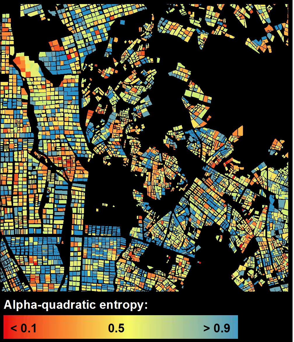
Agricultural management increasingly uses crop maps based on classification of remotely sensed data. However, classification errors can translate to errors in model outputs, for instance agricultural production monitoring (yield, water demand) or crop acreage calculation. Hence, knowledge on the spatial variability of the classier performance is important information for the user. But this is not provided by traditional assessments of accuracy, which are based on the confusion matrix. In this study, classification uncertainty was analyzed, based on the support vector machines (SVM) algorithm.
SVM was applied to multi-spectral time series data of RapidEye from different agricultural landscapes and years. Entropy was calculated as a measure of classification uncertainty, based on the per-object class membership estimations from the SVM algorithm. Permuting all possible combinations of available images allowed investigating the impact of the image acquisition frequency and timing, respectively, on the classification uncertainty. Results show that multi-temporal datasets decrease classification uncertainty for different crops compared to single data sets, but there was no “one-image-combination-fits-all” solution. The number and acquisition timing of the images, for which a decrease in uncertainty could be realized, proved to be specific to a given landscape, and for each crop they differed across different landscapes. For some crops, an increase of uncertainty was observed when increasing the quantity of images, even if classification accuracy was improved. Random forest regression was employed to investigate the impact of different explanatory variables on the observed spatial pattern of classification uncertainty. It was strongly influenced by factors related with the agricultural management and training sample density. Lower uncertainties were revealed for fields close to rivers or irrigation canals.
This study demonstrates that classification uncertainty estimates by the SVM algorithm provide a valuable addition to traditional accuracy assessments. This allows analyzing spatial variations of the classifier performance in maps and also differences in classification uncertainty within the growing season and between crop types, respectively.
A full text of this paper can be found at:
http://www.sciencedirect.com/science/article/pii/S0924271615000635


