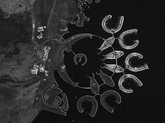
Innolab presentation: Deep Learning-driven Image Super-Resolution for TerraSAR-X

Innolab presentation: Deep Learning-driven Image Super-Resolution for TerraSAR-X

m

October 22, 2024

On November 05, 2024, Jannik Hoffmann will present his InnoLab results on ” Deep Learning-driven Image Super-Resolution for TerraSAR-X” at 12:00 in seminar room 3, John-Skilton-Str. 4a.
From the abstract: High-resolution satellite Synthetic Aperture Radar (SAR) data is crucial in many application areas such as defence, urban and infrastructure monitoring, disaster response, or business intelligence solutions. However, those are currently limited by high costs and technical compromises between image resolution and coverage area. This project employs cutting-edge artificial intelligence to enhance the resolution of SAR images to provide affordable high-resolution data with wide coverage. The objectives of the Innovation Lab within the Geo-Intelligence division at Airbus included various preprocessing tasks of Terra-SAR-X Radar data and the development, training and evaluation of a super-resolution model adapted to the acquired data.
Supervisor: Prof. Dr. Tobias Ullmann
Hosting Institution: Airbus Defence and Space

you may also like:

A Glimpse into Our Research: Data on Display in the Foyer

A Glimpse into Our Research: Data on Display in the Foyer

Stepping into the foyer, visitors are now greeted by large, striking images that tell the story of our research through data. Each visual represents a unique scientific perspective – from the Arctic to the cultivated landscapes of Bavaria, and from forest canopies to...

Successful MSc defense by Sonja Maas

Successful MSc defense by Sonja Maas

Big congratulations to Sonja Maas, who successfully defended her Master thesis today on the highly relevant and increasingly pressing topic: LiDAR-Based Acquisition Strategies for Forest Management Planning in a Mature Beech Stand Supervised by Dr. Julian Fäth and...

Visit at the Institute for Geoinformatics (IFGI) at University of Münster

Visit at the Institute for Geoinformatics (IFGI) at University of Münster

Two days ago, our PostDoc Dr. Jakob Schwalb-Willmann visited the Institute for Geoinformatics at University of Münster to give a talk at IFGI’s GI Forum titled “Can animals be used to classify land use? Employing movement-tracked animals as environmental informants using deep learning”.