Empowering Students with SAGA GIS for Environmental Applications

Empowering Students with SAGA GIS for Environmental Applications

m

January 16, 2025

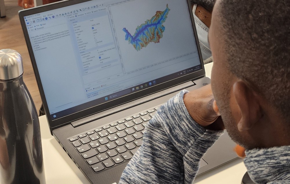
At EAGLE Earth Observation, we are committed to equipping our students with the tools and knowledge needed to excel in the field of environmental science. As part of this effort, our students are exploring the power of various scientific open-source software packages tailored for specific environmental applications, such as hydrology modeling using SAGA GIS.

SAGA GIS (System for Automated Geoscientific Analyses) is a robust open-source Geographic Information System designed for spatial analysis and modeling. Known for its versatility and user-friendly interface, SAGA GIS is widely used in environmental research, enabling users to process and analyze geodata with a focus on tasks like terrain analysis, hydrology, and climate data processing.

It’s inspiring to see the growing expertise of our students, supported by diverse software tools, programming languages, and methodologies that prepare them for a successful scientific future. This training is guided by Dr. Martin Wegmann and Ariane Droin, as part of the international M.Sc. program EAGLE.

Together, we’re fostering a generation of scientists ready to tackle environmental challenges with confidence and innovation.

you may also like:

A Glimpse into Our Research: Data on Display in the Foyer

A Glimpse into Our Research: Data on Display in the Foyer

Stepping into the foyer, visitors are now greeted by large, striking images that tell the story of our research through data. Each visual represents a unique scientific perspective – from the Arctic to the cultivated landscapes of Bavaria, and from forest canopies to...

Successful MSc defense by Sonja Maas

Successful MSc defense by Sonja Maas

Big congratulations to Sonja Maas, who successfully defended her Master thesis today on the highly relevant and increasingly pressing topic: LiDAR-Based Acquisition Strategies for Forest Management Planning in a Mature Beech Stand Supervised by Dr. Julian Fäth and...

Visit at the Institute for Geoinformatics (IFGI) at University of Münster

Visit at the Institute for Geoinformatics (IFGI) at University of Münster

Two days ago, our PostDoc Dr. Jakob Schwalb-Willmann visited the Institute for Geoinformatics at University of Münster to give a talk at IFGI’s GI Forum titled “Can animals be used to classify land use? Employing movement-tracked animals as environmental informants using deep learning”.

Privacy Policy

Lehrstuhl für Fernerkundung & Lehrstuhl für Urbane Fernerkundung

Erdbeobachtung an der Universität Würzburg