New RapidEye datasets granted from RESA platform of DLR/Black Bridge

New RapidEye datasets granted from RESA platform of DLR/Black Bridge

July 14, 2015

The Dept. of Remote Sensing recently applied for a time series of 7 RapidEye scenes to support a PhD thesis by M.Sc Omid Karami (Sari University of Agricultural and Natural Resources Sciences, Iran). The proposal is now accepted, and th PhD work will be supported by a time series of RapidEye scenes acquired between 07.2009 and 09.2014 over a semi-Meditteranean forested site in Lorestan province in Western Iran.

The PhD thesis which will use these processed datasets is entitled  “Monitoring and modelling of Zagros forest oak decline using high resolution satellite data”, supervised and advised by Dr. Asghar Fallah (Sari University of Agricultural and Natural Resources Sciences), Dr. Shaban Shataee (University of Gorgan) and Dr. Hooman Latifi (University of Würzburg). Additional multisource datasets to be used within the work include very high resolution data from Quickbird and World View-2.

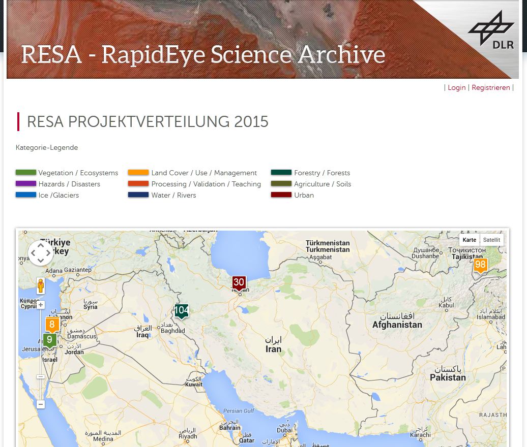
RESA already published this project in RESA project map 2015 which can be found online HERE. The project area is flagged under No. 104 (project number 168) in the map.

resa_iran

The RapidEye Science Archive (RESA) supported by DLR (BMWi) and Black Bridge AG supports scientific projects with German participation through the provision of free image data of the RapidEye satellite constellation. The projects are given the opportunity on an extensive image archive to get current and archived satellite image data to ensure optimal support for individual research projects.

you may also like:

Poster Presentation at AK Hydrologie, Bonn

Poster Presentation at AK Hydrologie, Bonn

From November 13 to 15, Sofia Haag and Christian Schäfer attended the AK Hydrologie workshop in Bonn, where they presented their work from the EO4CAM project. The first day featured an insightful field excursion to the Ahrtal region, led by Prof. Dr. Jürgen Herget,...

A Glimpse into Our Research: Data on Display in the Foyer

A Glimpse into Our Research: Data on Display in the Foyer

Stepping into the foyer, visitors are now greeted by large, striking images that tell the story of our research through data. Each visual represents a unique scientific perspective – from the Arctic to the cultivated landscapes of Bavaria, and from forest canopies to...

Successful MSc defense by Sonja Maas

Successful MSc defense by Sonja Maas

Big congratulations to Sonja Maas, who successfully defended her Master thesis today on the highly relevant and increasingly pressing topic: LiDAR-Based Acquisition Strategies for Forest Management Planning in a Mature Beech Stand Supervised by Dr. Julian Fäth and...

Visit at the Institute for Geoinformatics (IFGI) at University of Münster

Visit at the Institute for Geoinformatics (IFGI) at University of Münster

Two days ago, our PostDoc Dr. Jakob Schwalb-Willmann visited the Institute for Geoinformatics at University of Münster to give a talk at IFGI’s GI Forum titled “Can animals be used to classify land use? Employing movement-tracked animals as environmental informants using deep learning”.