cooperative project with DLR ZKI

cooperative project with DLR ZKI

m

April 29, 2024

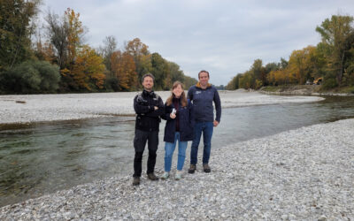
In cooperation with the DLR ZKI did we conduct drone flights last week using Lidar and oblique sensors in order to provide valuable landscape information for autonomous vehicle navigation. Within the project the feasibility to map unknown areas and its accessibility for rapid response and humanitarian aid using UAS borne sensors is analysed.
The data will now be processed and shared with our colleagues from ZKI for navigating the SHERP system through different terrains. Currently the approach is tested within Germany but of course it is planned to transfer such approaches to areas where actual humanitarian aid is required.

you may also like:

Spatial R Packages Showcase by our EAGLE students

Spatial R Packages Showcase by our EAGLE students

We are very proud to share the diverse submissions of spatial R packages within the EAGLE M.Sc. course of Ariane Droin and Martin Wegmann aiming at advancing our students' knowlege about programming for environmental analysis, geospatial visualization, and ecological...

NetCDA acitivities at EGU

NetCDA acitivities at EGU

We had a wonderful day yesterday at the EGU with NetCDA. We were pleasantly surprised by the great interest in climate-related capacity development activities in Africa. Throughout the day, we engaged in enriching discussions with many inspiring colleagues from a wide...