Course content:
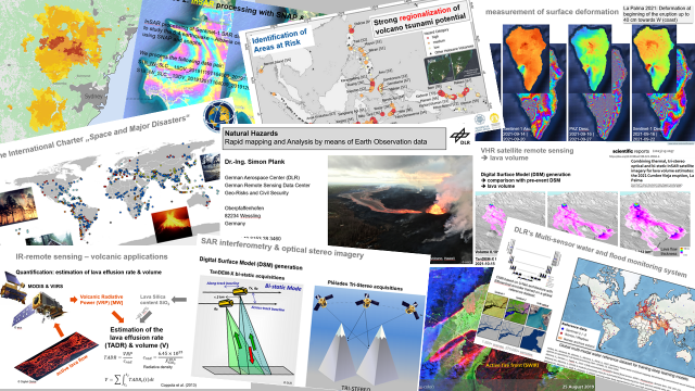
1. Comprehensive Overview of EO Techniques: The course provides an in-depth look at various Earth Observation remote sensing techniques, including thermal, optical, Synthetic Aperture Radar (SAR), and multi-sensor EO. Each of these methods plays a crucial role in monitoring and analyzing natural hazards, enabling timely and effective responses.
- Thermal Remote Sensing: This technique allows for the detection of heat emitted from the Earth’s surface, which is particularly useful in identifying active volcanoes and monitoring wildfires.
- Optical Remote Sensing: Utilizing visible light, optical sensors capture detailed imagery of the Earth’s surface, aiding in the assessment of land use changes and damage assessments after disasters.
- Synthetic Aperture Radar (SAR): SAR is a powerful tool for observing the Earth’s surface regardless of weather conditions or daylight. This capability is essential for monitoring landslides, floods, and other disasters.
- Pol/InSAR: This advanced technique enhances the capability of SAR by providing information on surface deformation, which is vital for understanding earthquakes and volcanic activity.
2. Practical Exercises: The course emphasizes hands-on learning through practical exercises using tools such as SNAP (Sentinel Application Platform) and Google Earth Engine. Students engage in short exercises that simulate real-world scenarios, allowing them to apply theoretical knowledge to practical situations.
3. Application to Natural Hazards: Throughout the course, students explore the application of these remote sensing techniques in the rapid mapping and analysis of various natural hazards, including:
- Volcanoes: Monitoring activity and understanding eruption processes.
- Landslides: Assessing risk areas and potential impacts.
- Earthquakes: Analyzing ground deformation and damage assessment.
- Tsunamis: Mapping affected areas for emergency response.
- Storms and Floods: Monitoring weather patterns and mapping flood damages.
- Fires: Rapid assessment of wildfire spread and damage.
Why This Course Matters
As climate change continues to exacerbate the frequency and intensity of natural disasters, the need for effective disaster management strategies has never been more urgent. This course not only equips students with technical skills but also fosters a deeper understanding of the socio-economic impacts of disasters.
Dr. Simon Plank’s course is an essential step for those aspiring to make a difference in the field of disaster management. By integrating cutting-edge EO techniques with practical exercises, students emerge as well-rounded professionals ready to tackle the challenges of natural hazards.
If you’re interested in the intersection of technology and disaster management, this course in the EAGLE MSc program is an excellent opportunity. It prepares students to respond effectively to natural disasters, leveraging the power of Earth Observation techniques to save lives and mitigate damage.
For more information on the Eagle MSc program and to stay updated on course offerings, visit www.eagle-science.org. Engage with the latest in disaster management education and become part of the solution in a world facing increasing environmental challenges


