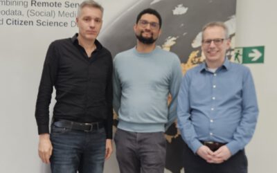
In a world where precise geographical data is becoming increasingly crucial, researchers from the Institute of Informatics at the University of Würzburg have made an important use case in mobile mapping technology. The latest development, led by Professor Andreas Nüchter and his team, combines high-tech sensors with advanced roboters and algorithms to create faster and more accurate 3D maps for areas difficult to map by humans. During a joint visit of the research station “Schneefernerhaus” on Zugspitze explorative data acquisitions were conducted by his team and compared with our Lidar data sets.
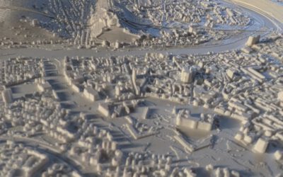
Mobile mapping—the process of collecting geo-spatial data from moving platforms—has seen rapid advancements in recent years. The research team’s innovative approach integrates LiDAR, cameras, and other sensor technologies to significantly improve the quality and speed of data acquisition. This means enhanced 3D models of cities, forests, and infrastructure, benefiting industries such as urban planning, environmental monitoring, and disaster response.
For us, the EORC is it relevant in many ways because we cannot always get up-to-date very high resolution spatial data of certain regions. Imagine mapping small permafrost tunnels, tunnels inside glaciers, or emergency responders being able to navigate disaster-stricken areas with real-time 3D maps or urban developers optimizing city layouts with pinpoint accuracy. The impact of these advancements stretches across multiple sectors, making mobile mapping a vital tool for the future.
The Earth Observation Research Cluster recognizes the immense potential of this research and is actively seeking new collaborations to expand its applications. By joining forces with researchers from informatics, namely Andreas Nüchter, we can harness these advancements to explore new research fields and create insights in global change patterns.
We look forward to seeing how mobile mapping evolves and how interdisciplinary partnerships will shape the future of Earth observation.
Check out this news article about the work done by Prof. Andreas Nüchter and planned applications of such technology in Earth Observation or geography research in general.
https://www.uni-wuerzburg.de/aktuelles/pressemitteilungen/single/news/nuechter-mobile-mapping/