MSc thesis handed in on predicting forest understory canopy cover

MSc thesis handed in on predicting forest understory canopy cover

May 9, 2016

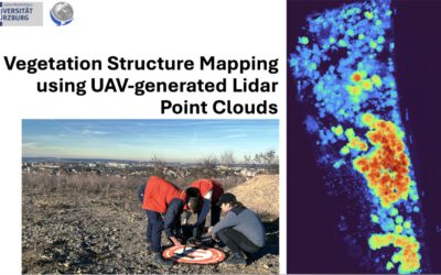
A M.Sc thesis was written by Bastian Schumann under the supervision of Dr. Hooman Latifi and Prof. Christopher Conrad that focused on a LiDAR-based approach to combine structural metrics and forest habitat informaiton for causal and predictive models of understory canopy cover. The data base used consisted of a bi-temporal LiDAR dataset as well as two field datasets and two habitat maps. The entire data were initially edited, revealing that a bi-temporal treatment is only possible for understory layers. The statistical models used for modelling canopy cover density included random forest, logistic models and zero-and-one inflated beta regression.

The results revealed the most relevant LiDAR metrics which contribute to explain the canopy cover density. Furthermore it indicates that the habitat types have a significant influence on canopy cover density. In addition, it was shown that with the use of a denser point cloud a higher performance can be achieved in almost every vertical stand layer.

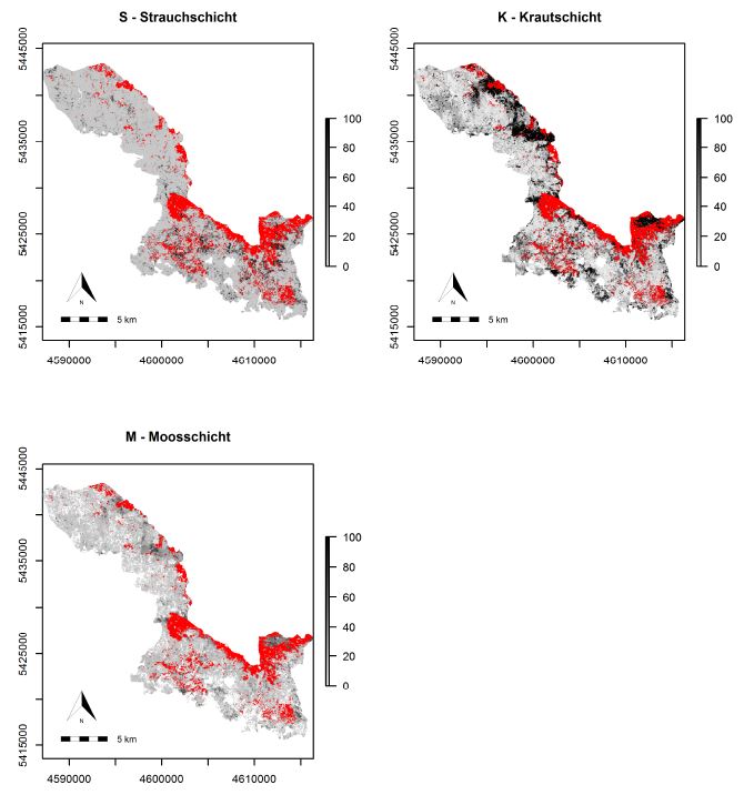
Wall-to-wall predictions of understory canopy cover usign high density point cloud, habitat types and a logistic model

Wall-to-wall predictions of understory canopy cover usign high density point cloud, habitat types and a logistic model

you may also like:

PhD position: Earth Observation of drought and fire impacts

PhD position: Earth Observation of drought and fire impacts

Job Announcement: PhD Position on EO research of Drought, Fire and Vegetation in Kruger National Park, South Africa Position: PhD ResearcherStudy Area: Kruger National Park, South AfricaApplication Deadline: until position is filledStart Date: as soon as possible...

Empowering Students with SAGA GIS for Environmental Applications

Empowering Students with SAGA GIS for Environmental Applications

At EAGLE Earth Observation, we are committed to equipping our students with the tools and knowledge needed to excel in the field of environmental science. As part of this effort, our students are exploring the power of various scientific open-source software packages...

EUSI meets GZS

EUSI meets GZS

Following the European Space Imaging Conference (EUSI) in December 2024 (DLR and EORC contributed to the conference. We reported on this – please see here: https://remote-sensing.org/keynote-presentation-at-eusi-conference-2024/), the long-standing partners met...

Successful Master Thesis Defense by Konstantin Müller

Successful Master Thesis Defense by Konstantin Müller

On January 14th, Konstantin Müller successfully defended his master’s thesis titled "Animal Path Segmentation and Analysis via Generalized Deep Neural Network Regression". Supervised by Jakob Schwalb-Willmann and Dr. Mirjana Bevanda, the presentation was delivered to...