 Our new article about the definition of the spatial resolution requirements for crop identification using optical remote sensing has been published in a special issue on Remote Sensing in Food Production and Food Security.
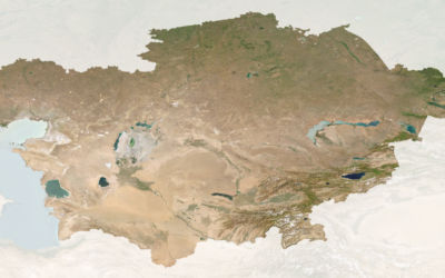
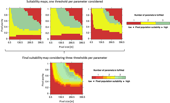
Abstract: The past decades have seen an increasing demand for operational monitoring of crop conditions and food production at local to global scales. To properly use satellite Earth observation for such agricultural monitoring, high temporal revisit frequency over vast geographic areas is necessary. However, this often limits the spatial resolution that can be used. The challenge of discriminating pixels that correspond to a particular crop type, a prerequisite for crop specific agricultural monitoring, remains daunting when the signal encoded in pixels stems from several land uses (mixed pixels), e.g., over heterogeneous landscapes where individual fields are often smaller than individual pixels. The question of determining the optimal pixel sizes for an application such as crop identification is therefore naturally inclined towards finding the coarsest acceptable pixel sizes, so as to potentially benefit from what instruments with coarser pixels can offer. To answer this question, this study builds upon and extends a conceptual framework to quantitatively define pixel size requirements for crop identification via image classification. This tool can be modulated using different parameterizations to explore trade-offs between pixel size and pixel purity when addressing the question of crop identification. Results over contrasting landscapes in Central Asia demonstrate that the task of finding the optimum pixel size does not have a “one-size-fits-all” solution. The resulting values for pixel size and purity that are suitable for crop identification proved to be specific to a given landscape, and for each crop they differed across different landscapes. Over the same time series, different crops were not identifiable simultaneously in the season and these requirements further changed over the years, reflecting the different agro-ecological conditions the crops are growing in. Results indicate that sensors like MODIS (250 m) could be suitable for identifying major crop classes in the study sites, whilst sensors like Landsat (30 m) should be considered for object-based classification. The proposed framework is generic and can be applied to any agricultural landscape, thereby potentially serving to guide recommendations for designing dedicated EO missions that can satisfy the requirements in terms of pixel size to identify and discriminate crop types.
Cite this article:
Löw, F.; Duveiller, G. Defining the Spatial Resolution Requirements for Crop Identification Using Optical Remote Sensing. Remote Sens. 2014, 6, 9034-9063.