new article: Spectral Mixture and Landscape Metrics Framework for Spatiotemporal Forest Cover Changes

new article: Spectral Mixture and Landscape Metrics Framework for Spatiotemporal Forest Cover Changes

April 18, 2022

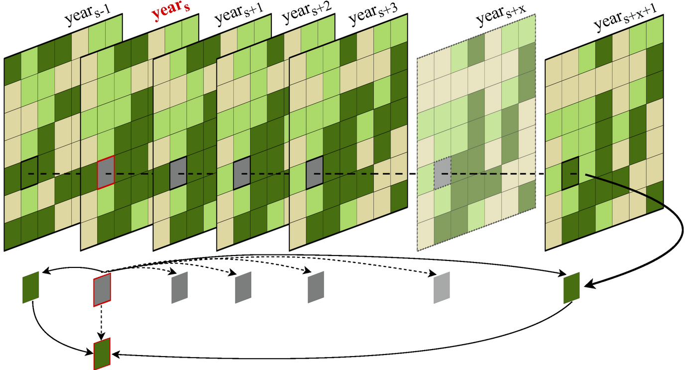
A new publication combining spectral mixture analysis and landscape metrics just got published. The title is “A Spectral Mixture Analysis and Landscape Metrics Based Framework for Monitoring Spatiotemporal Forest Cover Changes”, from the abstract: “An increasing amount of Brazilian rainforest is being lost or degraded for various reasons, both anthropogenic and natural, leading to a loss of biodiversity and further global consequences. Especially in the Brazilian state of Mato Grosso, soy production and large-scale cattle farms led to extensive losses of rainforest in recent years. We used a spectral mixture approach followed by a decision tree classification based on more than 30 years of Landsat data to quantify these losses. Research has shown that current methods for assessing forest degradation are lacking accuracy. Therefore, we generated classifications to determine land cover changes for each year, focusing on both cleared and degraded forest land. The analyses showed a decrease in forest area in Mato Grosso by 28.8% between 1986 and 2020. In order to measure changed forest structures for the selected period, fragmentation analyses based on diverse landscape metrics were carried out for the municipality of Colniza in Mato Grosso. It was found that forest areas experienced also a high degree of fragmentation over the study period, with an increase of 83.3% of the number of patches and a decrease of the mean patch area of 86.1% for the selected time period, resulting in altered habitats for flora and fauna”

read the full article here:

Halbgewachs M, Wegmann M, da Ponte E. A Spectral Mixture Analysis and Landscape Metrics Based Framework for Monitoring Spatiotemporal Forest Cover Changes: A Case Study in Mato Grosso, Brazil. Remote Sensing. 2022; 14(8):1907. https://doi.org/10.3390/rs14081907

you may also like:

Workshop on “Geodata, (social) media data and linguistics”

Workshop on “Geodata, (social) media data and linguistics”

On 26 February 2025, a workshop on "Geodata, (social) media data and linguistics" was held at DLR in Oberpfaffenhofen. Colleagues from the German Remote Sensing Data Center (DFD) of the DLR and from the Chair of English Linguistics as well as our Earth Observation...

UAS Team Acquires high alpine snow data

UAS Team Acquires high alpine snow data

In a remarkable display of teamwork, our UAS (Unoccupied Aerial Systems) team has successfully managed to overcome some technical obstacles present since last summer on UAS data collection in steep terrain and acquired a wealth of data using lidar, multispectral, and...

Datacube Retreat in Pfronten

Datacube Retreat in Pfronten

Last week, our EORC staff member Insa Otte, Steven Hill, Christoph Friedrich as well as Johannes Löw from University Halle-Wittenberg conducted a Datacube retreat for three days in Pfronten near the Alps. Besides quality team building time on joint hikes, important...

AgriSens DEMMIN 4.0 results symposium

AgriSens DEMMIN 4.0 results symposium

The AgriSens DEMMIN 4.0 results symposium is currently running at the Neubrandenburg University of Applied Sciences with many guests from economic practice, but also from politics and business. The project results are presented and discussed in terms of their...

Science Slam in Rosenheim: Hannes Taubenböck wins again

Science Slam in Rosenheim: Hannes Taubenböck wins again

After the completely surprising win of the Science Slam in Würzburg in November 2024 (we reported about it: https://remote-sensing.org/hannes-taubenbock-represents-eorc-at-the-science-slam-and-wins/), Hannes Taubenböck was invited to the Science Slam in Rosenheim. The...