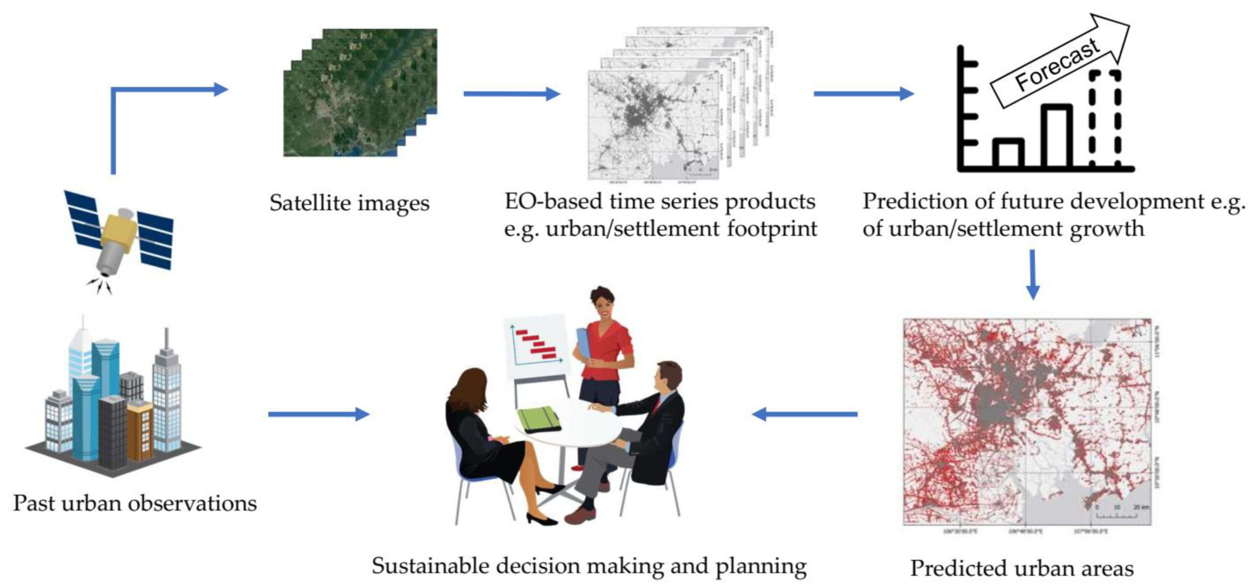

A new publication is just published on “Spatial Modelling and Prediction with the Spatio-Temporal Matrix: A Study on Predicting Future Settlement Growth” by various colleagues of Prof. Claudia Kuenzer. From the abstract: “In the past decades, various Earth observation-based time series products have emerged, which have enabled studies and analysis of global change processes. Besides their contribution to understanding past processes, time series datasets hold enormous potential for predictive modeling and thereby meet the demands of decision makers on future scenarios. In order to further exploit these data, a novel pixel-based approach has been introduced, which is the spatio-temporal matrix (STM). The approach integrates the historical characteristics of a specific land cover at a high temporal frequency in order to interpret the spatial and temporal information for the neighborhood of a given target pixel. The provided information can be exploited with common predictive models and algorithms. In this study, this approach was utilized and evaluated for the prediction of future urban/built-settlement growth. Random forest and multi-layer perceptron were employed for the prediction. The tests have been carried out with training strategies based on a one-year and a ten-year time span for the urban agglomerations of Surat (India), Ho-Chi-Minh City (Vietnam), and Abidjan (Ivory Coast). The slope, land use, exclusion, urban, transportation, hillshade (SLEUTH) model was selected as a baseline indicator for the performance evaluation. The statistical results from the receiver operating characteristic curve (ROC) demonstrate a good ability of the STM to facilitate the prediction of future settlement growth and its transferability to different cities, with area under the curve (AUC) values greater than 0.85. Compared with SLEUTH, the STM-based model achieved higher AUC in all of the test cases, while being independent of the additional datasets for the restricted and the preferential development areas.”
read the full article here: https://www.mdpi.com/2073-445X/11/8/1174