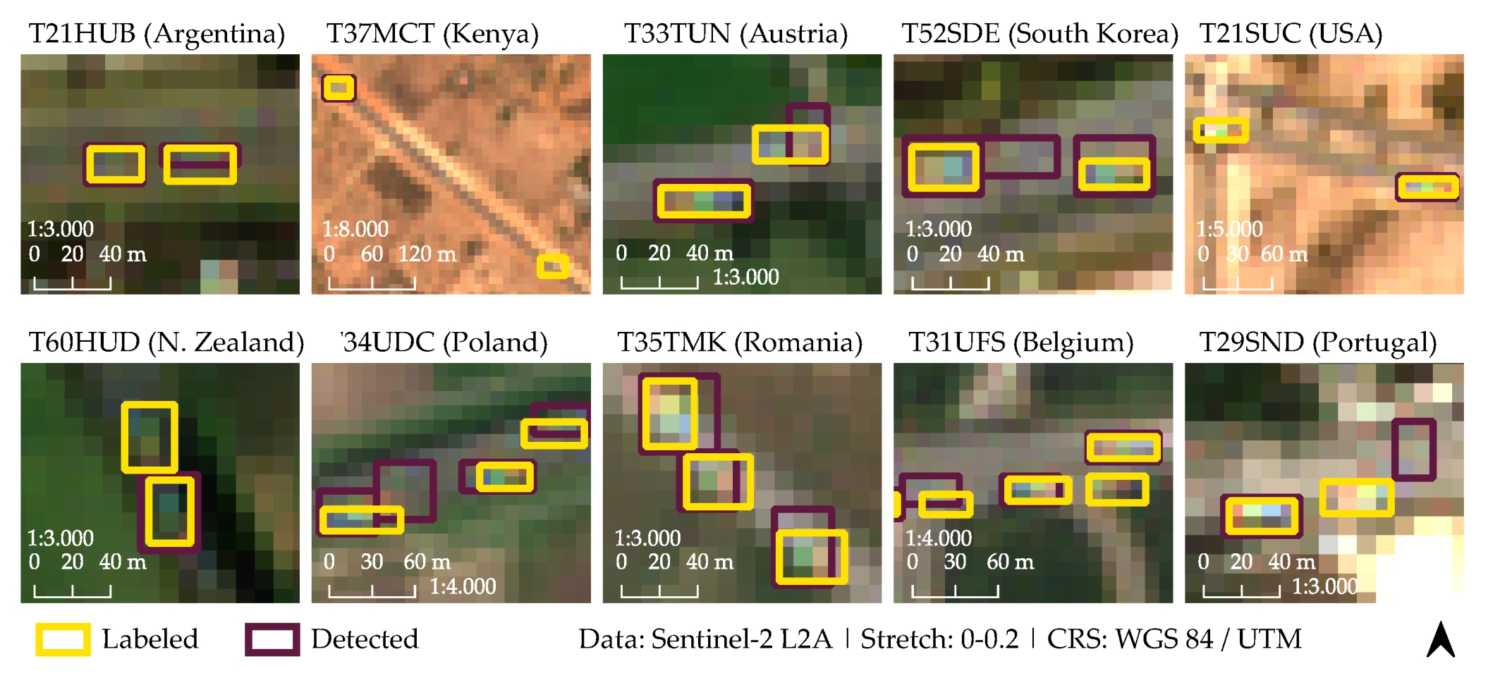
Our EAGLE student Henrik Fisser published his M.Sc. thesis “Detecting Moving Trucks on Roads Using Sentinel-2 Data” in Remote Sensing. From the abstract: “In most countries, freight is predominantly transported by road cargo trucks. We present a new satellite remote sensing method for detecting moving trucks on roads using Sentinel-2 data. The method exploits a temporal sensing offset of the Sentinel-2 multispectral instrument, causing spatially and spectrally distorted signatures of moving objects. A random forest classifier was trained (overall accuracy: 84%) on visual-near-infrared-spectra of 2500 globally labelled targets. Based on the classification, the target objects were extracted using a developed recursive neighbourhood search. The speed and the heading of the objects were approximated. Detections were validated by employing 350 globally labelled target boxes (mean F1 score: 0.74). The lowest F1 score was achieved in Kenya (0.36), the highest in Poland (0.88). Furthermore, validated at 26 traffic count stations in Germany on in sum 390 dates, the truck detections correlate spatio-temporally with station figures (Pearson r-value: 0.82, RMSE: 43.7). Absolute counts were underestimated on 81% of the dates. The detection performance may differ by season and road condition. Hence, the method is only suitable for approximating the relative truck traffic abundance rather than providing accurate absolute counts. However, existing road cargo monitoring methods that rely on traffic count stations or very high resolution remote sensing data have limited global availability. The proposed moving truck detection method could fill this gap, particularly where other information on road cargo traffic are sparse by employing globally and freely available Sentinel-2 data. It is inferior to the accuracy and the temporal detail of station counts, but superior in terms of spatial coverage.”
read the full article here:
Fisser, H.; Khorsandi, E.; Wegmann, M.; Baier, F. Detecting Moving Trucks on Roads Using Sentinel-2 Data. Remote Sens. 2022, 14, 1595. https://doi.org/10.3390/rs14071595

