New publication on Tree Competition R package TreeCompR

New publication on Tree Competition R package TreeCompR

April 8, 2024

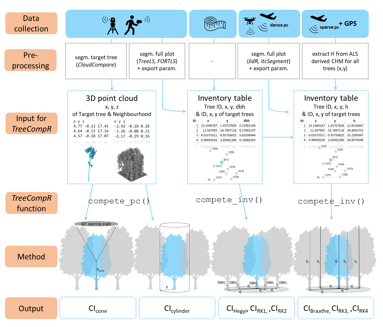
One of our staff members of the Earth Observation Research Cluster (EORC), Julia Rieder, just published a new R package titled “TreeCompR: Tree competition indices for inventory data and 3D point clouds”.
From the abstract:
1. In times of more frequent global-change-type droughts and associated tree mortality events, competition release is one silvicultural measure discussed to have an impact on the resilience of managed forest stands. Understanding how trees compete with each other is therefore crucial, but different measurement options and competition indices leave users with the agony of choice, as no single competition index has proven universally superior. 2. To help users with the choice and computation of appropriate indices, we present the open-source/TreeCompR/ package, which can handle 3D point clouds in various formats as well as classical forest inventory data and serves as a centralized platform for exploring and comparing different competition indices (CIs). Within a common interface, users can efficiently select the most suitable CI for their specific research questions. The package facilitates the integration of both traditional distance-dependent and novel point cloud-based indices. 3. To evaluate the package, we used/TreeCompR/ to quantify the competition situation of 308 European beech trees from 13 sites in Central Europe. Based on this dataset, we discuss the interpretation, comparability and sensitivity of the different indices to their parameterization and identify possible sources of uncertainty and ways to minimize them. 4. The compatibility of/TreeCompR/ with different data formats and different data collection methods makes it accessible and useful for a wide range of users, specifically ecologists and foresters. Due to the flexibility in the choice of input formats as well as the emphasis on tidy, well-structured output, our package can easily be integrated into existing data-analysis workflows both for 3D point cloud and classical forest inventory data.
Access to full preprint: www.biorxiv.org/content/10.1101/2024.03.23.586379v1 <www.biorxiv.org/content/10.1101/2024.03.23.586379v1>
Access to the R package:https://github.com/juliarieder/TreeCompR <github.com/juliarieder/TreeCompR>

you may also like:

Our research site and project covered by BR

Our research site and project covered by BR

The University forest at Sailershausen is a unique forest owned by the University of Wuerzburg. It comes with a high diversity of trees and most important is part of various research projects. We conducted various UAS/UAV/drone flights with Lidar, multispectral and...

Meeting of the FluBig Project Team

Meeting of the FluBig Project Team

During the last two days, the team of the FluBig project (remote-sensing.org/new-dfg-project-on-fluvial-research/) met at the EORC for discussing the ongoing work on fluvial biogeomorphology. After returning from a successful field expedition to Kyrgyzstan a couple of...

‘Super Test Site Würzburg’ project meeting

‘Super Test Site Würzburg’ project meeting

After the successful "Super Test Site Würzburg" measurement campaign in June (please see here: https://remote-sensing.org/super-test-site-wurzburg-from-the-idea-to-realization/ ), the core team from the University of Würzburg, the Karlsruhe Institute of Technology,...

EORC Talk: Geolingual Studies: A New Research Direction

EORC Talk: Geolingual Studies: A New Research Direction

On July 19th, Lisa Lehnen and Richard Lemoine Rodríguez, two postdoctoral researchers of the Geolingual Studies project, gave an inspiring presentation at the EORC talk series.   In the talk titled "Geolingual Studies – a new research direction", they...

EO support for UrbanPArt field work

EO support for UrbanPArt field work

From May to September, Karla Wenner, a PhD student at the Juniorprofessorship for Applied Biodiversity Science, will be sampling urban green spaces and semi-natural grasslands in Würzburg as part of the UrbanPArt project. Our cargo bikes support the research project...

Cinematic drone shots

Cinematic drone shots

We spend quite some time in the field conducting field work, from lidar measurements to vegetation samples in order to correlate it with remote sensing data to answer various research questions concerning global change. Field work is always a 24/7 work load and...