I’m proud to share my first review article on trends in satellite earth observation for permafrost related analyses in the open access journal Remote Sensing by MDPI together with my co-authors Andreas Dietz, Sebastian Buchelt and Claudia Künzer. This review is part of a joint PhD project between the Department of Remote Sensing at the University of Würzburg and the Team Polar and Cold Regions within the Department Land Surface Dynamics at the German Aerospace Center (DLR).
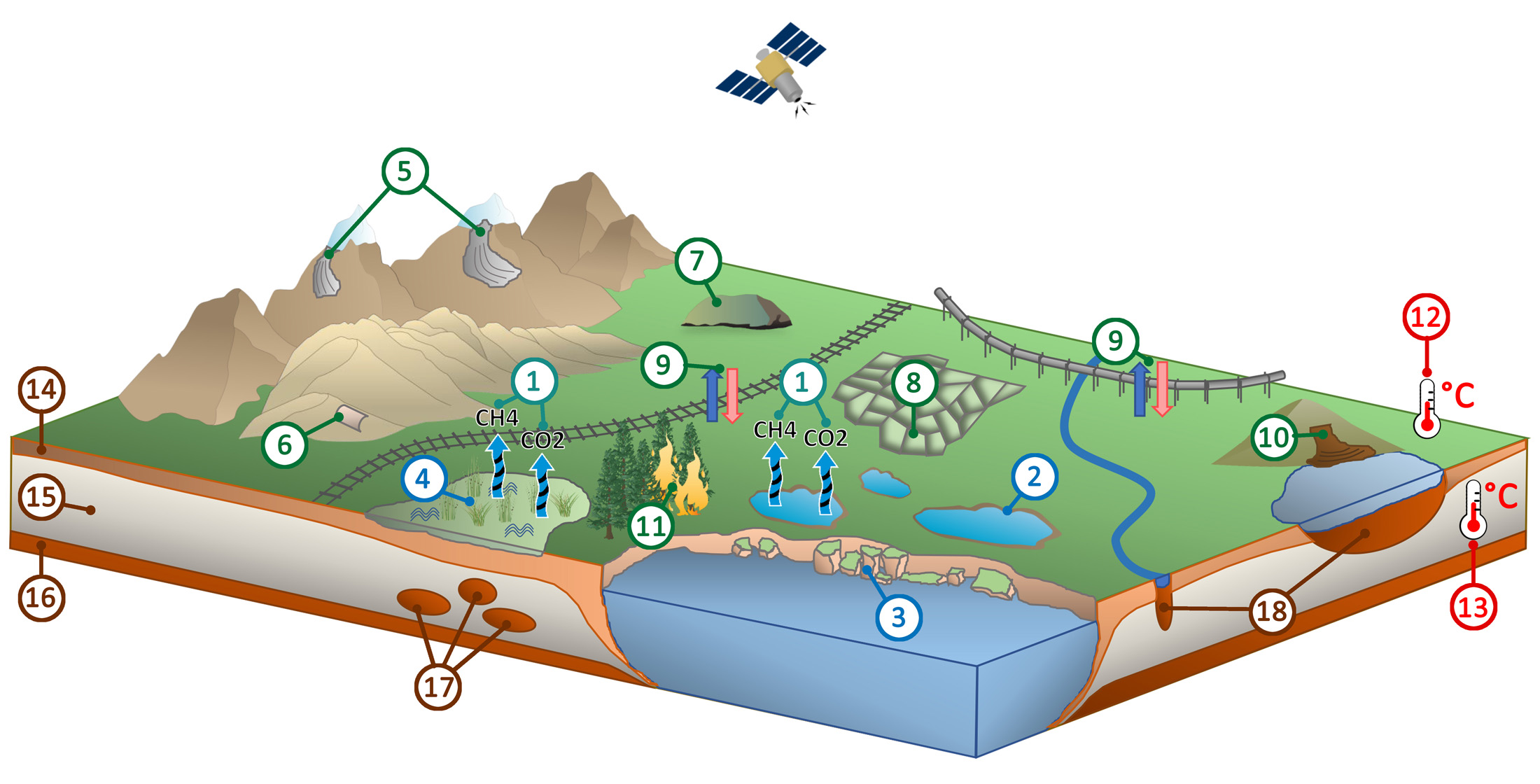
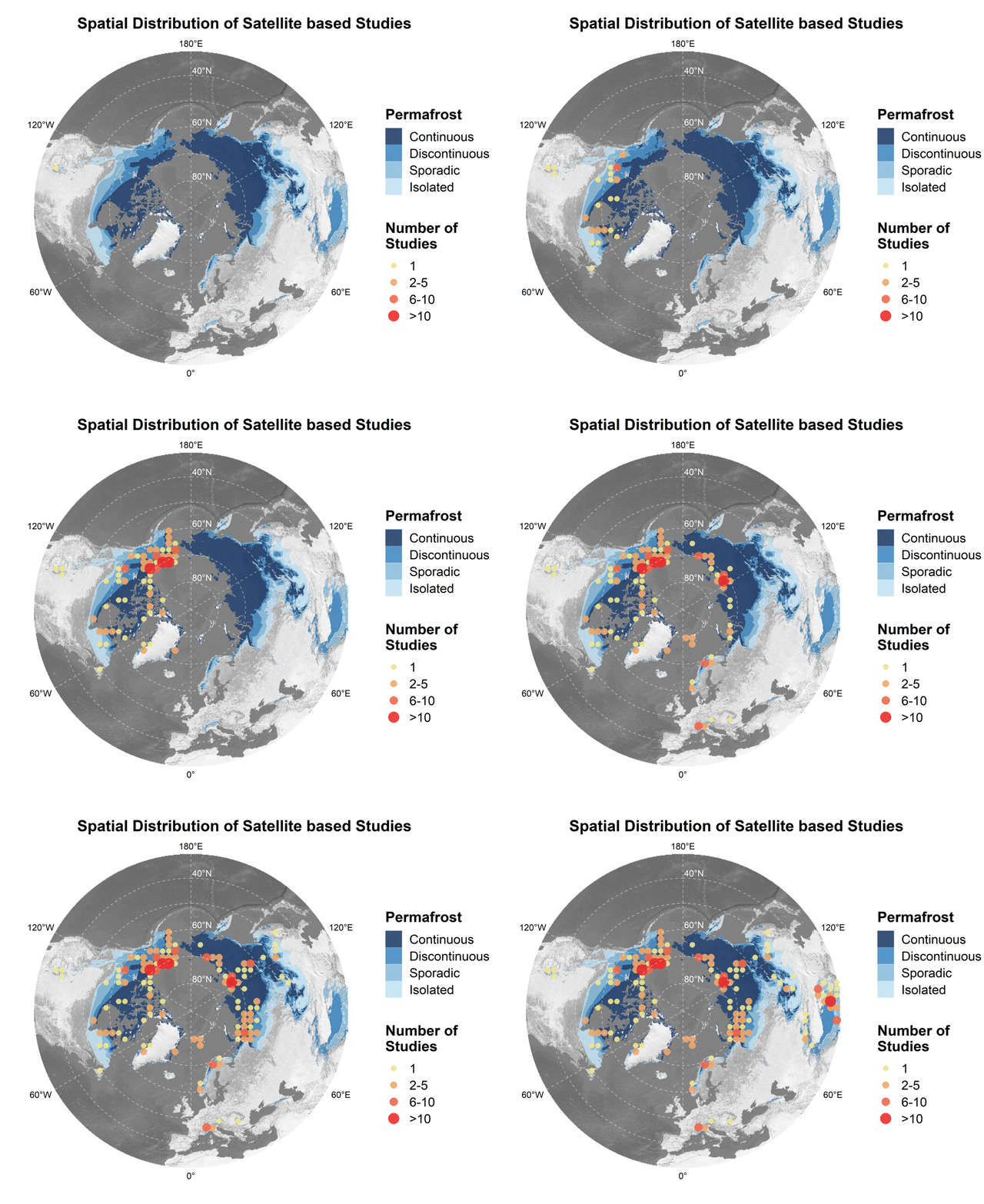
From the abstract: “Climate change and associated Arctic amplification cause a degradation of permafrost which in turn has major implications for the environment. The potential turnover of frozen ground from a carbon sink to a carbon source, eroding coastlines, landslides, amplified surface deformation and endangerment of human infrastructure are some of the consequences connected with thawing permafrost. Satellite remote sensing is hereby a powerful tool to identify and monitor these features and processes on a spatially explicit, cheap, operational, long-term basis and up to circum-Arctic scale. By filtering after a selection of relevant keywords, a total of 325 articles from 30 international journals published during the last two decades were analyzed based on study location, spatiotemporal resolution of applied remote sensing data, platform, sensor combination and studied environmental focus for a comprehensive overview of past achievements, current efforts, together with future challenges and opportunities. The temporal development of publication frequency, utilized platforms/sensors and the addressed environmental topic is thereby highlighted. The total number of publications more than doubled since 2015. Distinct geographical study hot spots were revealed, while at the same time large portions of the continuous permafrost zone are still only sparsely covered by satellite remote sensing investigations. Moreover, studies related to Arctic greenhouse gas emissions in the context of permafrost degradation appear heavily underrepresented. New tools (e.g., Google Earth Engine (GEE)), methodologies (e.g., deep learning or data fusion etc.) and satellite data (e.g., the Methane Remote Sensing LiDAR Mission (Merlin) and the Sentinel-fleet) will thereby enable future studies to further investigate the distribution of permafrost, its thermal state and its implications on the environment such as thermokarst features and greenhouse gas emission rates on increasingly larger spatial and temporal scales.”
Further Reading:
For more information on permafrost research at the Department of Remote Sensing visit http://permafrost.remote-sensing.org/.

