Our research introduced to the JMU president Pauli

Our research introduced to the JMU president Pauli

m

April 22, 2024

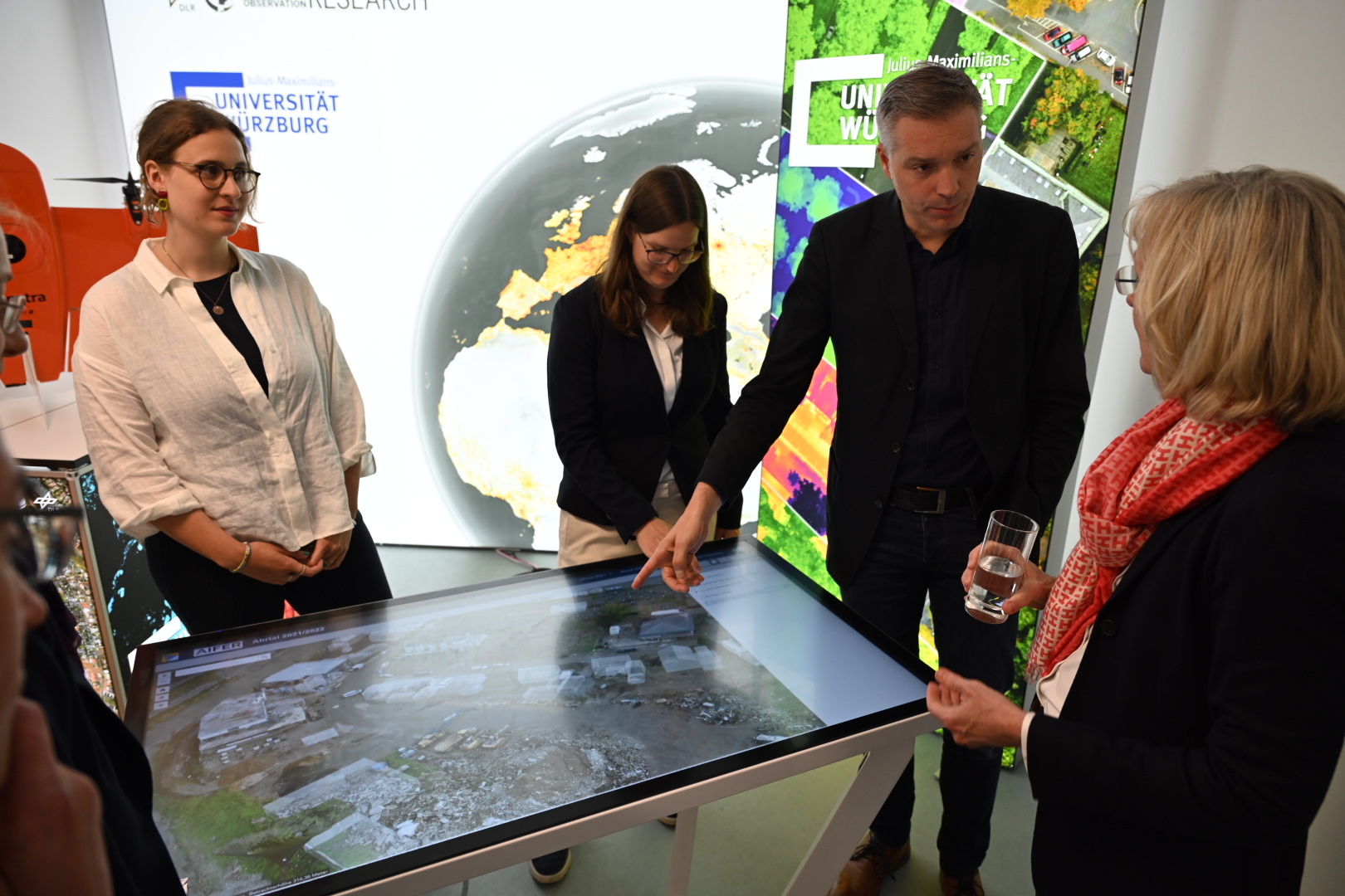
At the opening of the Center for Artificial Intelligence and Data Science (CAIDAS) on Friday, April 18, 2024, we had the opportunity to present the research of our Earth Observation Research Cluster (EORC) and of the Earth Observation Center (EOC) of the German Aerospace Center (DLR) to representatives from politics and society. Our EORC managing director Dr. Martin Wegmann, our PhD student Ariane Droin, our EAGLE student Anna Bischof and our professor Hannes Taubenböck presented the work to Prof. Dr. Paul Pauli, the President of our Julius-Maximillian’s University as well as the vice president for research, Prof. Caroline Kisker.

During this event various remote sensing analysis were shown, from urban tree mapping or urban heat islands up to Lidar tree height, vegetation structure as well as further diverse derived geoinformation from drone flights for forest monitoring or drones/UAS as support after a crisis situation to help decision-makers. In order to visualize our research we used an interactive touch-table to allow users to pan and zoom through the data plus change the content displayed on the table.

you may also like:

Successful Master’s thesis defense by Prince Lartey Lawson

Successful Master’s thesis defense by Prince Lartey Lawson

Our EAGLE Prince Lartey Lawson successfully defended his Master's thesis today (April 30th) titled "" Unmasking the Shadow Economy in Ghana: Mapping the Distribution of Umbrella Covered Informal Vendors In Kumasi". From the abstract of his thesis: Informal trade in...

Spatial Earth Observation R packages by our EAGLEs

Spatial Earth Observation R packages by our EAGLEs

Our EAGLE students that took and passed our Introduction to spatial programming course had to submit an R package that applies spatial methods for a variety of Earth Observation data. We are very proud to show the huge diversity of very interesting and useful R...

cooperative project with DLR ZKI

cooperative project with DLR ZKI

In cooperation with the DLR ZKI did we conduct drone flights last week using Lidar and oblique sensors in order to provide valuable landscape information for autonomous vehicle navigation. Within the project the feasibility to map unknown areas and its accessibility...

Object oriented image classification course

Object oriented image classification course

Today our EAGLE object based image analysis (OBIA) started, taught by our colleague Dr Michael Wurm, team leader at the DLR Earth Observation center GZS department.  Michael is covering the theory and practice of OBIA in his class and thereby broadening the...