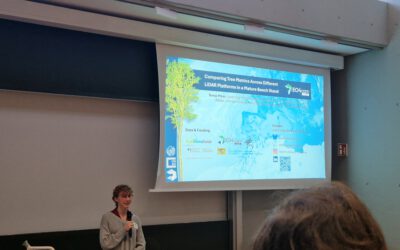
Dorothee Stiller will defend her PhD thesis “Potential of Remote Sensing Data and Methods for Urban Transport Research” on 15th of September at 4 p.m. at the John-Skilton Straße 4a, seminar Room 2/00.B.03. Everyone who is interested is cordially invited to join her presentation and the following discussion.
From her abstract: Urban transport underpins access to employment, education, healthcare, and other essential services, thereby shaping social inclusion. Yet rapid urbanization and rising traffic volumes intensify competition for limited space, challenge network capacity, degrade environmental quality, and exacerbate social and health inequities. Advances in remote sensing and open geospatial data present new opportunities for data-driven, empirically grounded urban and transport planning.
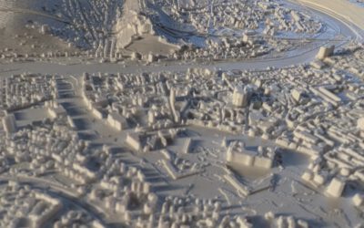
This dissertation demonstrates how integrating remote sensing, open geospatial datasets, and deep learning can bridge critical data gaps and support sustainable urban development. Using case studies in Santiago de Chile, Medellín (Colombia), and Berlin (Germany), the study develops a multimodal framework for mapping urban structures and mobility patterns. For Santiago de Chile, high-resolution 3D building models and fine-scale population estimates were generated from satellite imagery by using deep learning-based building segmentation, elevation models, OpenStreetMap data, and street-view imagery. The presented approach enables detailed spatial analysis, particularly valuable for data-scarce contexts.
Public transport accessibility is evaluated in relation to Sustainable Development Goal (SDG) Indicator 11.2, with emphasis on social and spatial equity. In Medellín, multiple population datasets, including remote sensing-derived and globally available sources, were used for analyzing the accessibility to public transport. Findings reveal the central role of the semi-formal minibus system, in extending service coverage, while also exposing persistent inequities: socioeconomically disadvantaged populations face markedly longer walking distances to formal public transport stops. These results highlight the utility of geospatial analysis for informing equitable mobility strategies.
This research further assesses the potential of open webcam data for scalable, cost-effective traffic monitoring. Applying the YOLOv8 object detection model to ~500,000 images from Berlin captured before and during the COVID-19 pandemic revealed significant modal shifts: motorized traffic declined by 9.5%, while bicycle traffic increased by 25.2%. These outcomes illustrate the feasibility of leveraging open webcams for large-scale, longitudinal mobility analysis, complementing traditional, resource-intensive methods.
Collectively, the findings of this PhD thesis show that combining remote sensing, open geospatial data, and advanced machine learning yields robust, scalable, and affordable datasets for urban structure and transport analysis. This integrative approach strengthens the evidence base for sustainable mobility planning and offers practical pathways to address persistent social and spatial inequalities in rapidly evolving urban environments.