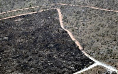
The high northern latitudes as well as the mountain environments have undergone a significant warming over the last decades and climate projections indicate an accelerated warming of these systems, exceeding the global average. Changing climatic conditions imply changes in the eco- and geosystem, e.g. loss of permanently frozen ground, increase of the active layer thickness, increasing magnitude and frequency of mass wasting and erosion events, or significant altering of the hydrology. Considering the consequences of the change and the role of the permafrost as one of the “Essential Climate Variables” there is a high need to estimate and continuously monitor environmental parameters of the periglacial system over large regions.
In this context satellite remote sensing and geophysical surveying techniques provide helpful tools for environmental research in landscapes and regions dominated by periglacial processes. Both techniques are capable to provide remote sampling of surface and subsurface properties for large areas. Therefore, these techniques are ideally combined to better comprehend the dynamics of inherent processes. Combining subsurface geophysical data and surface parameters captured by remote sensing allows the recognition, identification and quantification of interdependencies and interconnections of periglacial dynamics and ultimately supports the identification of driving forces of change.
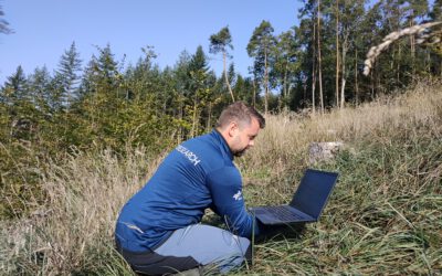
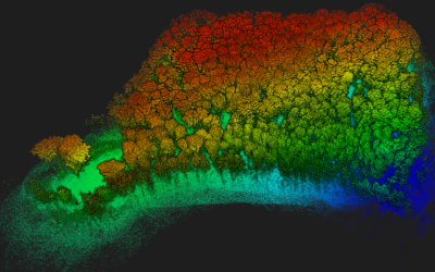
This project ought to investigate the linking of high-resolution multi-sensor remote sensing data (i.e., LiDAR, SAR and multispectral imagery) acquired by drones and earth observation satellites with in-situ data collected by geophysical measurements to characterize periglacial dynamics in the European Alps and/or Arctic regions. The project particularly focusses on the analyses of short- and long-term temporal dynamics and their triggers as well as on the detection and quantification of spatio-temporal patterns of surface deformation of typical periglacial landform elements, such as rock glaciers, solifluction lobes, or retrogressive thaw slumps.
Candidates are expected to pursue a PhD degree within this project.
Requirements:
We are seeking a highly motivated candidate holding a M.Sc. degree with expertise in remote sensing and/or geophysical surveying, and handling of various sources of geodata. A sound knowledge in remote sensing or geophysical software, geographic information systems (GIS) and programming (e.g., Python, R) is required. The ability to work independently as well as within an interdisciplinary team of collaborators is essential. A strong interest in applying interdisciplinary approaches, conducting field work, and to bridge gaps between Earth Observation, in-situ data collection and geophysics is required. Further, proficiency in the English language, and the capability to write research reports and peer-reviewed publications are required.
Working environment: We offer a stimulating research environment within an interdisciplinary, dynamic research team at the Earth Observation Research Hub and the Institute of Geography and Geology at the University of Würzburg in close collaboration with the German Remote Sensing Data Center of DLR. The position is financed for a duration of 3 years and should start in early 2023, with salary according to TV-L (65%).
Applicants are invited to submit their applications via email including a cover letter, CV and all necessary certificates to eo-contact@uni-wuerzburg.de before March 1st 2023. Please indicate the identification number (2023peri) in your application.The position is to be filled as soon as possible and offered for a fixed term of 3 years.
The University of Würzburg is an equal opportunity employer, determined to increase the proportion of women in successful scientific careers, and particularly encourages them to apply. Preference will be given to disabled applicants with the same qualifications. Inquiries or questions should be directed to:
Contact: Earth Observation Research Hub, Prof. Dr. Tobias Ullmann.