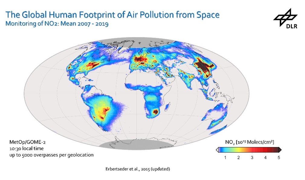
The Earth Observation Research Cluster (EORC) invites for a talk by Dr. Thilo Ebertseder and colleagues from the DLR entitled “Air Pollution (NO2) and Settlement Growth in Megacities“. The talk will be given in presence at the EORC (John-Skilton-Str. 4a) on Wednesday, May 8th, starting at 1 pm. We look forward to seeing you and to an interesting joint discussion. Save the date!
Thilo Erbertseder (1), Hannes Taubenböck (1,2), Thomas Esch (1), Lorenza Gilardi (1), Heiko Paeth (2), Stefan Dech (1,2): “Air Pollution (NO2) and Settlement Growth in Megacities”
- Deutsches Zentrum für Luft- und Raumfahrt (DLR) | German Aerospace Center | Earth Observation Center | German Remote Sensing Data Center | 82234 Wessling | Germany
- Julius-Maximilians-Universität Würzburg | Institute for Geography and Geology | 97074 Würzburg | Germany
Summary: Megacities have become global centers of industrial production, trade, and innovation, but also energy consumption, atmospheric emissions, and air pollution. Since air pollution is considered the largest single environmental health risk by the World Health Organization, we take a closer look at the evolution of the NO2 burden of megacities, which can be directly attributed to anthropogenic emission activity. Evaluating past air pollution trends gives insight into the effectiveness of policies to control these levels and supports the implementation and priorities of future policies. Despite several studies on NO2 changes in megacities, a systematic analysis in relation to settlement growth is still pending. In addition, previous studies do not refer to consistent spatial city concepts, which distorts statistics in the comparison. In this study, we examine the trends of NO2 air pollution in megacities in relation to urban settlement growth: Time series of tropospheric NO2 from GOME, SCIAMACHY, GOME-2A, and GOME-2B are evaluated regarding yearly settlement growth as derived from the World Settlement Footprint for the period from 1996 to 2015. Compared to previous studies, this work strictly uses remote sensing data and the spatial concept of Functional Urban Areas. Uncertainties due to incomparable administrative units, heterogeneously reported local data, and population counts are thus widely excluded to enable a reliable comparison of megacities across the globe. We find a wide spectrum of NO2 pollution trends and settlement growth rates. Despite this variety, the results exhibit a pronounced relation to the income group following the world’s economies classification by the World Bank. While the strongest NO2 pollution increases occur in megacities of lower-middle-income countries, the strongest settlement growth rates are observed in upper-middle-income countries. The lowest relative settlement growth rates and a decrease in NO2 air pollution predominantly characterize megacities in high-income countries. The presented method and findings contribute to shaping healthy, resilient, and sustainable cities according to the United Nations Sustainable Development Goals 3 and 11.
![]()

