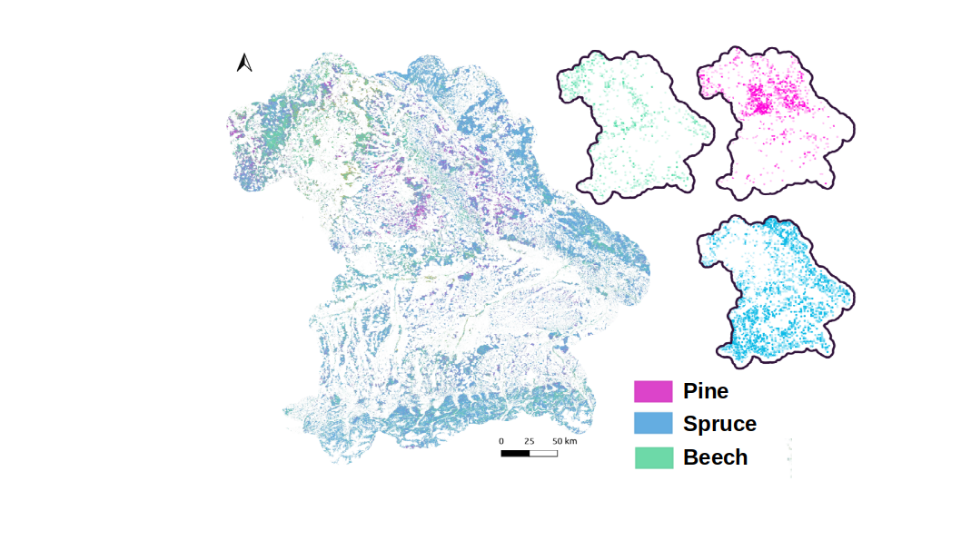
No, we are not talking about spruce experiments on ISS, but we map them from space, using Sentinel-2 satellite imagery from the European Space Agency. The main task of the ESPE project is to classify tree species like birches to improve the pollen forecasts to help people suffering from pollen emissions, caused by allergic reactions. Our final product can be used as an input variable in weather models. These models are describing the movement of wind packages. We provide information where these packages collect pollen causing allergies.
In December 2022 we invited members of the Bavarian State Ministry of Health and Care, and Environmental and Consumer Protection, the German Aerospace Center, the Center of Allergy and Environment, the Bavarian State Institute of Forestry, the Bayerische Staatsforsten and members of the University of Würzburg to workshop to discuss preliminary results of ESPE. For the first time, we presented our tree species product for the free state of Bavaria. We realized this map, by using modern cloud-based methods in a so called Datacube. These organizing structures are efficient databases, carrying multispectral satellite data and tools for analyzing and information extraction, e.g. by applying state of the art machine leaning techniques. We showed that our Bavarian Data Cube has the potential do this job in a very promising way. An essential part of the work is finding sufficient input variables to train models for classification tasks. We use balancing methods on ground truth data to train a machine learning classifier. Our prototype map is based on a single month of satellite data, already describing plausible distribution of tree species which are in line with data collected from the German forest inventories represented.
We would like to thank all participants of the December workshop and continue working to improve our classification by integrating more time steps to integrate tree species specific seasonal spectral appearance.
For further information please contact our colleague and developer of the map Sebastian Förtsch.


