UAS mission of monastery Bronnbach

UAS mission of monastery Bronnbach

m

April 22, 2024

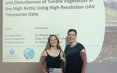
The potential of UAS data for mapping cultural heritage sites was discussed in the past months with colleagues associated with the UNESCO world heritage activities by our postdocs Dr. Mirjana Bevanda and Dr. Sarah Schönbrodt-Stitt. Based on these discussions further linkages to actual heritage site managers were established and a first pilot study was setup of a monastery close by. Our postdocs discussed the overarching goal and outline with the respective managers and the state to discuss the projects’ framework and envisioned outcome.  Our UAS team pilots covered the area last week, Antonio Castaneda, Elio Rauth and Jannis Middash conducted the data collection and completed a successful mission at Kloster Bronnbach. We gathered various data types, like lidar scans, high-res RGB, thermal, and multispectral images, to better understand the area’s features. The Kloster Bronnbach, known for its historical significance and diverse landscape, provided an ideal location for our mission. With our UAS, we captured detailed aerial views, recording every aspect of the terrain below. Our datasets, ranging from lidar scans to RGB images, offer valuable insights into surface features. These datasets hold great potential for discriminating between different features with remarkable clarity.
In the next steps the data will be analysed with regard to world heritage relevancy and further meetings of Dr. Sarah Schönbrodt-Stitt and Dr. Mirjana Bevanda with the partners of the respective organizations will define the further collaborations.

you may also like:

Our research site and project covered by BR

Our research site and project covered by BR

The University forest at Sailershausen is a unique forest owned by the University of Wuerzburg. It comes with a high diversity of trees and most important is part of various research projects. We conducted various UAS/UAV/drone flights with Lidar, multispectral and...

Meeting of the FluBig Project Team

Meeting of the FluBig Project Team

During the last two days, the team of the FluBig project (remote-sensing.org/new-dfg-project-on-fluvial-research/) met at the EORC for discussing the ongoing work on fluvial biogeomorphology. After returning from a successful field expedition to Kyrgyzstan a couple of...

‘Super Test Site Würzburg’ project meeting

‘Super Test Site Würzburg’ project meeting

After the successful "Super Test Site Würzburg" measurement campaign in June (please see here: https://remote-sensing.org/super-test-site-wurzburg-from-the-idea-to-realization/ ), the core team from the University of Würzburg, the Karlsruhe Institute of Technology,...

EORC Talk: Geolingual Studies: A New Research Direction

EORC Talk: Geolingual Studies: A New Research Direction

On July 19th, Lisa Lehnen and Richard Lemoine Rodríguez, two postdoctoral researchers of the Geolingual Studies project, gave an inspiring presentation at the EORC talk series.   In the talk titled "Geolingual Studies – a new research direction", they...

EO support for UrbanPArt field work

EO support for UrbanPArt field work

From May to September, Karla Wenner, a PhD student at the Juniorprofessorship for Applied Biodiversity Science, will be sampling urban green spaces and semi-natural grasslands in Würzburg as part of the UrbanPArt project. Our cargo bikes support the research project...

Cinematic drone shots

Cinematic drone shots

We spend quite some time in the field conducting field work, from lidar measurements to vegetation samples in order to correlate it with remote sensing data to answer various research questions concerning global change. Field work is always a 24/7 work load and...