


We are glad to announce our next workshop report at the Department of Remote Sensing, which will be also the last in the year 2020. On 09th December 2020, Dr. Christian Hüttich and Simon Sebold (both Department of Remote Sensing, University of Würzburg) will talk about “AgriSens DEMMIN 4.0 – Remote Sensing Technologies for Digitization in Crop Production”.
Abstract
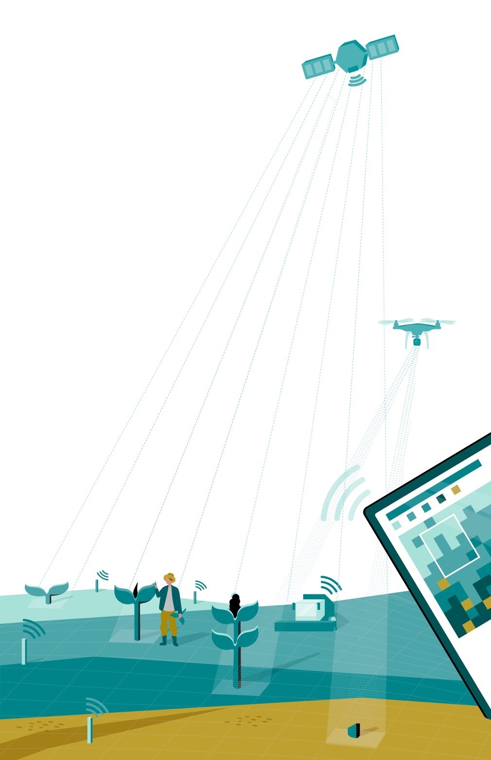
Digitization in agriculture: Geodata, particularly from remote sensing (RS) sensors on satellites, airplanes and drones, potentially enables farmers to increasing their productivity in the future while protecting the environment and promoting biodiversity. Within AgriSens DEMMIN 4.0 (RS technologies for digitization in crop production), a regional digital experimental field is being launched in Mecklenburg-Western Pomerania, near the city of Demmin, about 220 kilometers north of Berlin.
In addition to the core area in the Demmin area, the experimental field includes further test sites in Brandenburg and Saxony-Anhalt. The focus of AgriSens DEMMIN 4.0 is to precisely define and address applications of RS data from satellite and UAV-supported systems for concrete questions of crop cultivation, e.g. estimating crop yields, recording areas of reduced yield and determining irrigation requirements. We analyze the status of the use of geoinformation data in agriculture and design the implementation of application examples based on new and further development of methodological principles. The project aims to provide farmers with data sets from which they can obtain relevant information for their farming management. This information serves as a basis for decisions on how and when to apply measures such as fertilization, sowing, irrigation or soil cultivation. At present, the hurdle to use this data is unfortunately far too high for many farmers. This applies above all to access to the data, its use in a wide range of software solutions and confusing market offerings. Here, we would like to offer low-threshold solutions and geodata knowhow for farmers.
Title of presentation: AgriSens DEMMIN 4.0 – Remote Sensing Technologies for Digitization in Crop Production Presenters: Dr. Christian Hüttich and Simon Sebold (both Department of Remote Sensing, University of Würzburg)
Date: Wednesday, 09th December, 2020 Time: 10 – 11 am s.t. Place: Online Presentation language: English Slides: English


