Workshop Report at the Department of Remote Sensing – June 27, 2019

Workshop Report at the Department of Remote Sensing – June 27, 2019

June 21, 2019

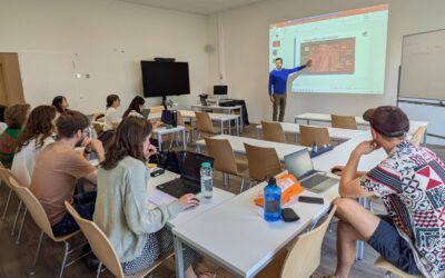
We are glad to announcing our next workshop at the Department of Remote Sensing for Thursday, 27th June 2019.

The presentation will be about

Irrigated Agriculture and Environment at the Glance of the NGO KRASS in the Lowlands of Uzbekistan, Central Asia

Abstract

The Khorezm region of Uzbekistan is located in the epicenter of the environmental disaster in Central Asia. This is mainly due to the regional expansion of irrigated agriculture during Soviet Union times, which has altered natural hydrology and environmental services in the Amu Darya delta leading to salinization and widespread desertification, known as ‘Aral Sea Syndrom’. The NGO KRASS (Khorezm Rural Advisory Support Service) has been established in 2008 within the frame of the ZEF/UNESCO Khorezm project in Urgench State University. KRASS is acting to promote rational use of land and water resources for the sustainable development, and mitigation of environmental problems by disseminating innovative, modern and improved agricultural and irrigation methods and techniques. It further aims to strengthen agricultural knowledge and skills of the farming population and the youth of rural Uzbekistan. GIS techniques and multi‐source remote sensing spectral information have enormous potential to determine, monitoring, and mapping agricultural land use, particularly land use types, and crop yield modelling for further better management of land and water resources in the region.

Title of presentation: Irrigated Agriculture and Environment at the Glance of the NGO KRASS in the Lowlands of Uzbekistan, Central Asia

Presenter: Murodjon Sultanov from the Urgench State University and NGO KRASS (Uzbekistan) and guest scientist in the CAWa project at the Department of Remote Sensing

Date: Thursday, 27th June Time: 10 – 11:00 am s.t. Place: Josef-Martin-Weg 52 (1), Campus Hubland Nord, Würzburg (place may be subject to change)

Presentation language: English Slides: English

All interested persons are cordially invited! We are looking forward to seeing you.

you may also like:

Our research site and project covered by BR

Our research site and project covered by BR

The University forest at Sailershausen is a unique forest owned by the University of Wuerzburg. It comes with a high diversity of trees and most important is part of various research projects. We conducted various UAS/UAV/drone flights with Lidar, multispectral and...

Meeting of the FluBig Project Team

Meeting of the FluBig Project Team

During the last two days, the team of the FluBig project (remote-sensing.org/new-dfg-project-on-fluvial-research/) met at the EORC for discussing the ongoing work on fluvial biogeomorphology. After returning from a successful field expedition to Kyrgyzstan a couple of...

‘Super Test Site Würzburg’ project meeting

‘Super Test Site Würzburg’ project meeting

After the successful "Super Test Site Würzburg" measurement campaign in June (please see here: https://remote-sensing.org/super-test-site-wurzburg-from-the-idea-to-realization/ ), the core team from the University of Würzburg, the Karlsruhe Institute of Technology,...

EORC Talk: Geolingual Studies: A New Research Direction

EORC Talk: Geolingual Studies: A New Research Direction

On July 19th, Lisa Lehnen and Richard Lemoine Rodríguez, two postdoctoral researchers of the Geolingual Studies project, gave an inspiring presentation at the EORC talk series.   In the talk titled "Geolingual Studies – a new research direction", they...

EO support for UrbanPArt field work

EO support for UrbanPArt field work

From May to September, Karla Wenner, a PhD student at the Juniorprofessorship for Applied Biodiversity Science, will be sampling urban green spaces and semi-natural grasslands in Würzburg as part of the UrbanPArt project. Our cargo bikes support the research project...

Cinematic drone shots

Cinematic drone shots

We spend quite some time in the field conducting field work, from lidar measurements to vegetation samples in order to correlate it with remote sensing data to answer various research questions concerning global change. Field work is always a 24/7 work load and...