image kindly provided by Marius Philipp
In February, the winter term 2017/18 ended, and here is a short summary on our teaching activities.
degree programms
courses given
students taught
The department is involved in 3 degree programs on geography at the University of Würzburg and in the “Global Change Ecology M.Sc.” graduate program of the Universities Bayreuth, Würzburg and Augsburg within the Elitenetwork of Bavaria.
Within the bachelor’s program “Geography”, 183 students visited our lecture on “Introduction to geographical Remote Sensing”. Our tutors Jana Maier, Florian Baumgartner, Patrick Horst and Jakob Rieser accompanied the lecture with weekly tutorials.
This term, 22 BSc students chose “Remote Sensing” as a minor. The course “Methods for Analysing Remote Sensing Data” essentially conveys methodological basics: data download, geometric and radiometric corrections, spatial and spectral filters, image enhancement, analysis of spectral profiles, information extraction (rationing, indices, transformations), classification of remote sensing imagery, accuracy assessment and change analysis. Learning about the joint usage of remote sensing data with other geoinformation in geographical information systems, the participants now can apply fundamental methods for the processing and analysis of optical EO data. They gave talks on different methods of data analysis and how to perform them in ENVI. Their tutor Leon Nill encouraged and supported the students and they are now busy carrying out change detection analysis on a topic of their choice using open geodata such as Landsat or Sentinel-2.
Within the master programes Applied Physical Geography and Applied Human Geography 13 students learned how to characterize the earth’s surface by assessing remotely sensed parameters. Landscape analysis with a focus on forests were performed and (inter)national assessment approaches, monitoring methods and programs were discussed.
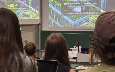
For our 17 first year EAGLE students, the semester isn’t finished yet, too. Specialization courses on Remote Sensing in Urban Geography and Hyperspectral Remote Sensing have been held, a course on Remote Sensing Time Series is ongoing. We’d like to thank our EAGLE lecturers and colleagues from DLR Dr. Hannes Taubenböck, Dr. Martin Bachmann and Dr. Andreas Dietz for their contribution and diverse coursework!
The EAGLE students starting in winter term 2016/17 are scattered all over the world working as interns at different host institutions or carrying out their innovation Laboratory.
The summer term 2018 will start in April and we offer 12 lectures and seminars given by the members of our department and additional 4 seminars in the EAGLE programme held by Dr. Nikola Koglin, PD Dr. Claudia Künzer, Prof. Dr. Hartwig Frimmel and Dr. Tobias Ullmann. We are looking forward to interesting talks and discussions about remote sensing and geography!