

Invitation to the talks of the upcoming professorship of Geographical Remote Sensing

Invitation to the talks of the upcoming professorship of Geographical Remote Sensing

m

June 5, 2018

Please find below the talk of the new upcoming professorship of Geographical Remote Sensing (in german only)

E I N L A D U N G

Im Rahmen des Verfahrens zur Wiederbesetzung der
W2-Professur für Geographische Fernerkundung

im Philosophiegebäude, Am Hubland, HS 4:

Freitag, 15.06.2018, 9 Uhr s.t.
spricht Herr Dr. Benjamin Bechtel, Hamburg, über das Thema:
„Zeitreihenanalyse und Fusion von satellitengestützten Thermaldaten“

Freitag, 15.06.2018, 11 Uhr s.t.
spricht Herr Prof. Dr. Christopher Conrad, Halle, über das Thema:
„Fernerkundung und nachhaltige Entwicklung von Agrarräumen“

Freitag, 15.06.2018, 14 Uhr s.t.
spricht Herr Dr. Hannes Feilhauer, Erlangen, über das Thema:
„Fernerkundung trifft Biogeographie: Beispiele raum-zeitlicher Analysen von Ökosystemen und
Ökosystemdienstleistungen mittels Erdbeobachtung“

Freitag, 15.06.2018, 16 Uhr s.t.
spricht Herr Dr. Sebastian van der Linden, Berlin, über das Thema:
„Beyond land cover – geographische Fernerkundung mit räumlich und zeitlich hochauflösenden
Erdbeobachtungsdaten“

Samstag, 16.06.2018, 9 Uhr s.t.
spricht Herr Dr. Michael Schmidt, Australien, über das Thema:
„Integrating Earth Observation data for sustainable Natural Resource Management“

Samstag, 16.06.2018, 11 Uhr s.t.
spricht PD Dr. habil. Christian Thiel, Jena, über das Thema:
„Abschätzung des Potentials von ALOS PALSAR Daten für die Ableitung des Stammvolumens in
Sibirien“

follow us and share it on:

you may also like:

Successful MSc Defense by Christina Krause

Successful MSc Defense by Christina Krause

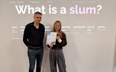
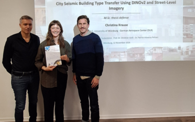
Congratulations to our EAGLE student Christina Krause, who successfully defended her MSc thesis titled "Active Learning and Parameter-Efficient Feature Adaptation for Cross-City Seismic Building Type Transfer Using DINOv2 and Street-Level Imagery" on November 12,...

Successful MSc Defense by Marlene Bauer

Successful MSc Defense by Marlene Bauer

Congratulations to our EAGLE student Marlene Bauer, who successfully defended her MSc thesis titled "Robust and Uncertainty-Aware Informal Settlement Mapping – Cross-City Generalisation Across Diverse Urban Morphologies Using High-Resolution Satellite Imagery in...

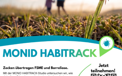
Help Us Understand Ticks: Join the MONID HABITRACK Study

Help Us Understand Ticks: Join the MONID HABITRACK Study

Lyme borreliosis and tick-borne encephalitis (TBE) are the most common tick-borne diseases in Germany, and they are becoming more relevant. Many infections go unnoticed because they cause mild symptoms or none at all. The MONID HABITRACK project, funded by the BMFTR,...

Setting Up for the 2nd EO4CAM Nutzerworkshop

Setting Up for the 2nd EO4CAM Nutzerworkshop

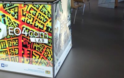
Right now our staff are busy hauling cases, mounting displays and testing every cable for the 2nd EO4CAM Nutzerworkshop, “Erdbeobachtung für die Klimaanpassung, behördliche Akteure in Bayern”. The doors open tomorrow, and the exhibition...

A dashboard for multi-UAS thermal data

A dashboard for multi-UAS thermal data

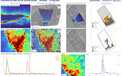
Mapping an active fire with various drones flying in parallel is hard enough. But getting the data processed, evaluated and turned into research datasets is a different story. The publication is on its way, and for now we’d like to share a dashboard by Antonio José...

bzgl. Art. 50 Verordnung (EU) 2024/1689 (AI Act):

Überwiegend werden eigene originäre Texte und Bilder des EORC genutzt, jedoch sind einige Inhalte von blog post Texten teilweise mit Hilfe von KI überarbeitet worden und einige Bilder sind ganz mit KI erstellt, die jedoch deutlich keine photorealistische Darstellungen abbilden. Aussnahmen sind KI generierte fernerkundliche Datensätze, die explizit für Forschungszwecke mit KI erstellt wurden, hier wird aber durch den assoziierten Text der wissenschaftliche Grund der KI generierten Bilder erläutert.

Share This