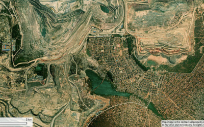
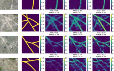
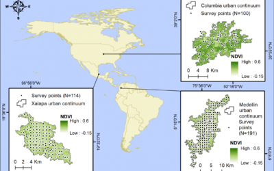
Ten years ago, our first scientific article on slums was published – a study on the morphological and structural differences between slums and formal settlements.
- The physical face of slums – A structural comparison of slums in Mumbai, India based on remotely sensed data. https://link.springer.com/article/10.1007/s10901-013-9333-x
This work was strongly motivated by impressions and experiences visiting areas of urban poverty across the globe – places where the struggle for existence, earning a living and access to urban opportunities may lead to arrival and social ascent, but also to failure and impoverishment. In a more journalistic contribution, we reflected on our personal impressions and thoughts of a visit in Paraisópolis, a favela in Sao Paulo, Brazil.
- Die Frucht des Paradieses – Reflektionen über den Besuch einer Favela in Sao Paulo. https://link.springer.com/article/10.1007/s00548-013-0303-z
We take this decade of research work as an opportunity now to take a brief look back at the work done at the Earth Observation Center (EOC) of the German Aerospace Center (DLR) in Oberpfaffenhofen and our Earth Observation Research Cluster (EORC) of the University Würzburg. Here is a short recap of the many thematic, methodological and ethical contributions on poverty, slums and informal settlements with remote sensing and other geodata:
On morphologic forms of the built environment:
- Housing forms of poverty in Europe – A categorization based on literature research and space imagery. https://www.sciencedirect.com/science/article/pii/S0143622822001916
- Mapping the morphology of urban deprivation: The role of remote sensing for developing a global slum repository. https://onlinelibrary.wiley.com/doi/10.1002/9781119625865.ch14
- The morphology of the Arrival City – A global categorization based on literature surveys and remotely sensed data. https://www.sciencedirect.com/science/article/pii/S0143622817309955
- Das globale Gesicht urbaner Armut? Siedlungsstrukturen in Slums. https://link.springer.com/chapter/10.1007/978-3-662-44841-0_12
On spatial patterns of the built environment:
- Planned, unplanned, or in-between? A concept of the intensity of plannedness and its empirical relation to the built urban landscape across the globe. https://www.sciencedirect.com/science/article/pii/S0169204623000300
- Size distributions for morphological slums in Asia and South America. https://ieeexplore.ieee.org/document/8809017
- Sensitivity of slum size distributions as a function of spatial parameters for slum classification. https://ieeexplore.ieee.org/abstract/document/8808944
- Capturing the urban divide in nighttime light images from the International Space Station. https://ieeexplore.ieee.org/document/8362725
- The similar size of slums. https://www.sciencedirect.com/science/article/pii/S0197397517309220
- Size Distributions of slums across the globe using different data and classification methods. https://www.tandfonline.com/doi/full/10.1080/22797254.2019.1579617
- Spatial patterns of slums – Comparing African and Asian cities. https://ieeexplore.ieee.org/document/7924587
On spatio-temporal dynamics:
- The Spatiotemporal Dynamics of Morphological Slums in Mumbai, India. https://ieeexplore.ieee.org/document/10613006
- Spatiotemporal dynamics of slum populations in Caracas, Venezuela. https://ieeexplore.ieee.org/document/10144182
- The dynamics of poor urban areas – Analyzing morphologic transformations across the globe using Earth Observation data. https://www.sciencedirect.com/science/article/pii/S0264275120312531
- How dynamic are slums? EO-based assessment of Kibera’s morphologic transformation. https://ieeexplore.ieee.org/document/8808978
- Urban transformation in the National Capital Territority of Delhi, India: The emergence and growth of slums? https://www.sciencedirect.com/science/article/pii/S0197397515000685
On classification methods using remotely sensed data:
- Quantifying uncertainty in slum detection: Advancing transfer learning with limited data in noisy urban environments. https://ieeexplore.ieee.org/document/10416343
- Uncertainties of human perception in visual image interpretation in complex urban environments. https://ieeexplore.ieee.org/document/9146616
- Satellite-based mapping of urban poverty with transfer learned slum morphologies. https://ieeexplore.ieee.org/document/9174807
- Semantic segmentation of slums in satellite images using transfer learning on fully convolutional neural networks. https://www.sciencedirect.com/science/article/pii/S0924271619300383
- Slum mapping in imbalanced remote sensing datasets using transfer learned deep features. https://ieeexplore.ieee.org/document/8808965
- Investigation on the separability of slums by multi-aspect TerraSAR-X dual-co-polarized high resolution spotlight images based on the multi-scale evaluation of local distributions. https://www.sciencedirect.com/science/article/pii/S0303243417301952
- Slum mapping based on multi-scale texture features in polarimetric SAR data. https://www.sciencedirect.com/science/article/pii/S0034425717301335
- The unseen population: Do we underestimate slum dwellers in cities of the Global South? https://www.sciencedirect.com/science/article/pii/S0197397524000560
- Ich weiß, dass ich nichts weiß – Bevölkerungsschätzung in einer Megacity. https://link.springer.com/chapter/10.1007/978-3-662-44841-0_18
On social aspects:
- Detecting social groups from space – Remote sensing-based mapping of morphological slums and assessment with income data. https://www.tandfonline.com/doi/full/10.1080/2150704X.2017.1384586
- Are the poor digitally left behind? Analyzing urban divides using remote sensing and twitter data. https://www.mdpi.com/2220-9964/7/8/304
- Digital deserts on the ground and from space – An experimental spatial analysis combining social network and earth observation data in megacity Mumbai. https://ieeexplore.ieee.org/document/7924562
On expsoure to natural hazards:
- Revealing landslide exposure of informal settlements in Medellín using Deep Learning. https://ieeexplore.ieee.org/document/10144128
- Misperceptions of predominant slum locations? Spatial analysis of slum locations in terms of topography based on earth observation data. https://www.mdpi.com/2072-4292/12/15/2474
We also looked at the ethical aspects of mapping and analyzing areas of urban poverty, slums and informal settlements using remote sensing and other geodata:
- Conducting Ethically Mindful Earth Observation Research: The Case of Slum Mapping. https://ieeexplore.ieee.org/document/10281725
- Artificial Intelligence for Earth Observation: Understanding emerging ethical issues and opportunities. https://ieeexplore.ieee.org/document/9954451
And we looked at some challenges in general:
- Monitoring and modelling of informal settlements – recent developments and challenges. https://ieeexplore.ieee.org/abstract/document/7120513
We would like to explicitly thank all our colleagues at DLR and the EORC, but also the many great researchers and research groups around the world with whom we have worked together to respond to the United Nations call for better data on poverty, slums and informal settlements. Explicit thanks to all the authors and co-authors of the studies and to the global network of colleagues. We are very much looking forward to the next decade of research!


