Stepping into the foyer, visitors are now greeted by large, striking images that tell the story of our research through data. Each visual represents a unique scientific perspective – from the Arctic to the cultivated landscapes of Bavaria, and from forest canopies to urban environments.
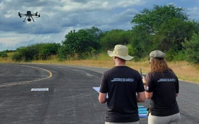
These displays are more than just decoration. They are windows into the diverse research activities carried out by our team at the EORC. Every dataset shown – whether captured by UAS LiDAR and multispectral sensors, or satellite imagery – has been collected, processed, and analysed by our own researchers.
Among the themes on display are:
-
Snow depth mapping in the Arctic, derived from UAS LiDAR data, revealing seasonal changes and climate impacts.
-
Agricultural yield mapping in Bavaria, based on Sentinel satellite observations, supporting more sustainable farming practices.
-
Forest structure analysis within our university’s research forest, combining multispectral and LiDAR UAS data to study topics like biodiversity and carbon storage.
-
Urban thermal analysis, using remote sensing data to better understand heat patterns and urban climate resilience.
Each image reflects not only scientific insight but also the dedication of the researchers behind it. Together, they create a vivid mosaic of what we do: observe, analyse, and understand our changing planet.
We invite visitors, colleagues, and workshop participants to take a closer look, start a conversation, and explore the questions and ideas that these visuals inspire. After all, research grows stronger when it is shared – and every image in our foyer is an open invitation to connect.