EAGLE Students Explore LiDAR Data with QGIS, Whitebox, and CloudCompare

EAGLE Students Explore LiDAR Data with QGIS, Whitebox, and CloudCompare

m

February 6, 2025

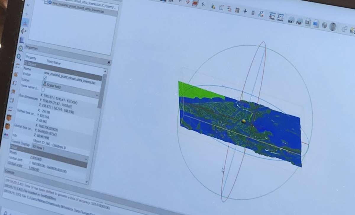
At EAGLE, our students continuously expand their expertise in Earth observation by learning various data processing techniques. Today, they are diving into LiDAR data analysis, using QGIS, Whitebox, and CloudCompare to enhance their skills in handling different remote sensing data and software solutions.

Mastering multiple tools is a key ability for any scientist, as real-world challenges often require a flexible and multidisciplinary approach. By working with different software, our students gain practical experience that prepares them for future research and professional applications.

Stay tuned for more updates on their exciting learning journey!

you may also like:

Recording the Sounds of a River

Recording the Sounds of a River

Over the weekend, EORC PI Florian Betz met with Martina Cecchetto and Riccardo Fumigalli from the University of Padua to conduct ambient sound recordings and collect photographs of the Lech River, one of the major tributaries of the upper Danube. The photographs and...

Our PhD Wall is Growing — and So Is Our Research Family!

Our PhD Wall is Growing — and So Is Our Research Family!

It’s been a remarkable year for our research team! The PhD Wall of Fame, showcasing all past and current doctoral researchers, has officially reached its limits — and we’ve had to expand it to make room for even more success stories. So far six PhD defenses have taken...

🎉 A Sweet Surprise for a Special Birthday!

🎉 A Sweet Surprise for a Special Birthday!

At our department, we not only work hard together — we also celebrate the milestones that make our team so special. This week, we had the joy of surprising our wonderful secretary Tine Linge on her 60th birthday! Early in the morning, colleagues gathered to prepare a...

Contribution at SilviLaser Conference in Quebec

Contribution at SilviLaser Conference in Quebec

At SilviLaser 2025 in Québec City, PhD candidate Julia Rieder (EORC, University of Würzburg and staff member of EO4CAM) presented her work on "European Beech under Drought: Effects of Topography, Competition and Soil Water Availability." Her study uses LiDAR to reveal...

EORC at Remote Sensing Symposium in Darmstadt

EORC at Remote Sensing Symposium in Darmstadt

On 2 October 2025, Dr. John Friesen and Dr. Julian Fäth from the Earth Observation Research Cluster (EORC) at the University of Würzburg and staff members of EO4CAM took part in the symposium "Vom Orbit zur Entscheidung: Satellitenfernerkundung in der...

New Team Member at the EORC: Sonja Mass

New Team Member at the EORC: Sonja Mass

Sonja Maas joined the Earth Observation Research Cluster (EORC) in October 2025 as a research assistant for the EO4CAM project. After finishing her bachelor's degree in forestry, Sonja Maas enrolled in the EAGLE M.Sc. program at the University of Würzburg, where she...

Privacy Policy

Lehrstuhl für Fernerkundung & Lehrstuhl für Urbane Fernerkundung

Erdbeobachtung an der Universität Würzburg