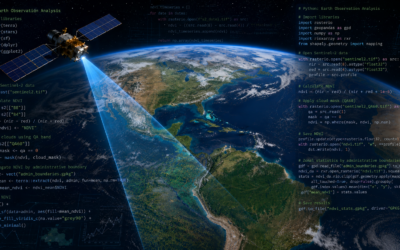
For our team, it was a great opportunity to share and discuss recent work on dynamic river systems, remote sensing, and biogeomorphic processes. Across several talks, posters, and sessions, our contributions highlighted how riverscapes can be understood as connected, evolving systems shaped by hydrology, geomorphology, vegetation, human influence, and Earth observation data. A central theme of our contributions was the use of remote sensing and geospatial data to better capture river dynamics across scales. In one presentation, we explored the potential of geospatial foundation models and Earth embeddings for assessing dynamic riverine processes. These emerging approaches offer promising ways to make use of the rapidly growing volume of satellite data and to derive transferable information on river morphology, vegetation, and hydrological dynamics.
Generally, our contributions focused around biogeomorphology and floodplain functioning. We presented work on fluvial biogeomorphic units across scales, emphasizing the need to link field-based understanding, spatial classification, and process interpretation. Another contribution addressed biogeomorphic feedbacks and hydrologic connectivity as key drivers of riverine ecosystem functioning, underlining how the interaction between water, landforms, and vegetation shapes habitat dynamics and ecosystem processes. Our team also contributed a remote sensing-based classification of floodplain vegetation along the Naryn River in Kyrgyzstan. This work connects satellite-based vegetation mapping with broader questions of river corridor dynamics, ecosystem functioning, and landscape-scale monitoring in highly dynamic river environments.
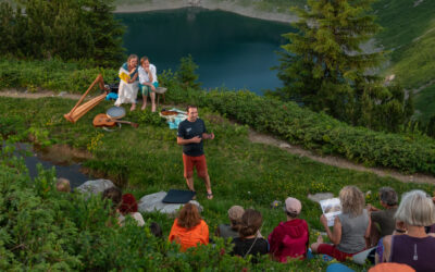
We were also involved in convening the session “Humans, life, and Earth surface dynamics (in the Anthropocene and beyond)”, which created space for broader discussions on how human activities, living systems, and geomorphic processes interact in a changing world. Beyond talks, posters and session convening, one special highlight was the contribution “Flow: A river’s story, revealed in movement and sound”, which brought together river science, visual storytelling, movement, and sound. This offered a different perspective on how rivers can be communicated beyond classical scientific formats and opened inspiring discussions on science, art, and public engagement.
Overall, EGU26 provided many valuable exchanges with colleagues working at the interface of remote sensing, geomorphology, ecology, hydrology, and environmental change. We return with new ideas, inspiring discussions, and motivation to further develop integrative approaches for understanding and monitoring dynamic river landscapes.