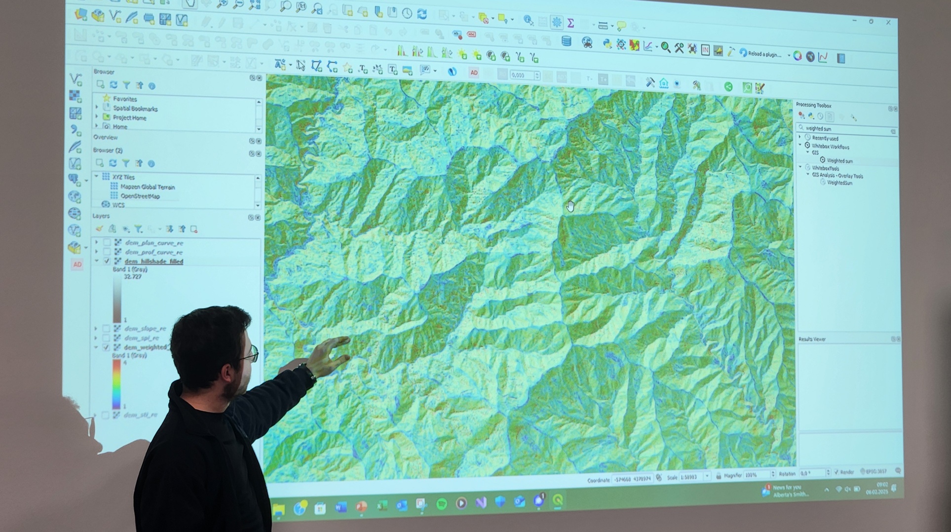
In the world of Earth observation and geospatial analysis, staying ahead of the curve requires familiarity with the diverse environments and various powerful scientific software tools. At EAGLE, our students have the opportunity to also explore the vast potential of WhiteboxTools, an open-source software suite that is well-known for terrain analysis, hydrological modeling, or geomorphological applications. Integrated seamlessly with QGIS, Whitebox provides an accessible yet sophisticated environment for tackling complex spatial challenges.
WhiteboxTools is known for its highly diverse functionalities, ranging from basic raster analysis to advanced hydrological and geomorphological modeling. Through hands-on exercises, our students engaged with a wide array of tools, including:
-
Hydrological Modeling: Delineating watersheds, calculating flow accumulation, and identifying stream networks.
-
Geomorphological Analysis: Extracting terrain indices, modeling surface roughness, and performing slope stability assessments.
-
Data Processing & Automation: Using Whitebox’s powerful scripting capabilities to automate geospatial workflows efficiently.
One of the key highlights of the training was learning how to seamlessly integrate WhiteboxTools within QGIS, one of the most widely used open-source GIS platforms. By leveraging QGIS’ plugin system, our students could run Whitebox operations directly from the QGIS interface, visualize their results in real time, and integrate their outputs with other geospatial datasets.
This integration opens up a world of possibilities for geospatial researchers. Whether analyzing flood susceptibility, mapping erosion-prone areas, or improving land surface classification, WhiteboxTools provides a flexible and innovative approach to tackling scientific problems.
By mastering scientific spatial software like Whitebox and QGIS, as well as CloudCompare, OTB, GRASS or SAGA, our EAGLE students are equipping themselves with essential skills for future careers in Earth observation, environmental modeling, and geospatial analytics. These tools empower them to perform cutting-edge research, apply their knowledge in real-world scenarios, and contribute valuable insights into pressing environmental challenges.
As technology continues to evolve, so too will the opportunities for geospatial professionals. At EAGLE, we ensure our students stay at the forefront of these developments—exploring, learning, and pushing the boundaries of what is possible in Earth observation science.
Stay tuned for more insights into our students’ exciting explorations in geospatial technology!


