Internship Presentation: Discovering Hydrographic Parameters of HydroSHEDS and TanDEM-X Digital Elevation Model through Exploratory Data Analysis on July 09, 2024

Internship Presentation: Discovering Hydrographic Parameters of HydroSHEDS and TanDEM-X Digital Elevation Model through Exploratory Data Analysis on July 09, 2024

June 26, 2024

On Tuesday, July 09, Subarno Shankar will present his internship ” Discovering Hydrographic Parameters of HydroSHEDS and TanDEM-X Digital Elevation Model through Exploratory Data Analysis ” at 12:00 in seminar room 3, John-Skilton-Str. 4a.
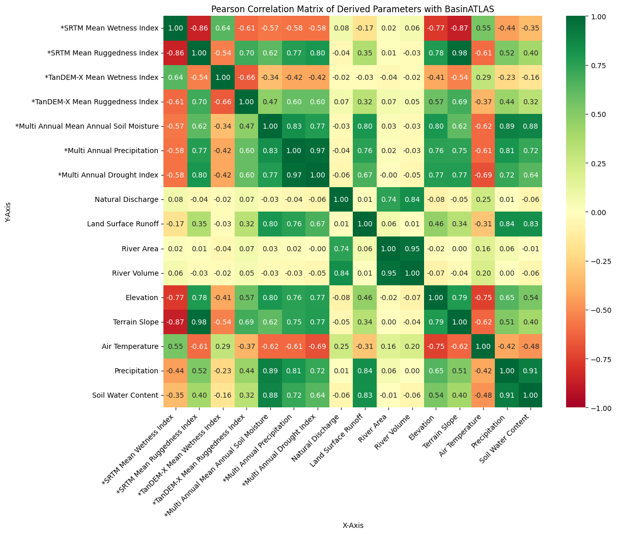
From the abstract: Climate change factors such as floods and droughts lead to hydrological effects that influence the intensity of catchment runoff, water flow, and quality. A global hydro-environmental dataset, HydroSHEDS v.2, is collaboratively developed by the German Aerospace Center (DLR), McGill University, Confluvio Consulting, and the World Wildlife Fund (WWF). This dataset provides consistent global coverage with a spatial resolution of 1 arc-second (30 meters), consisting of an underlying DEM known as TanDEM-X with a spatial resolution of 0.4 arc-second (12 meters). The aim was to develop and evaluate novel geomorphometric parameters at a sub-basin level for HydroSHEDS v.2 by utilizing geometries and the underlying DEM from the BasinATLAS dataset of HydroSHEDS v.1 and TanDEM-X, respectively. Geomorphometric parameters such as the Topographic Wetness Index (TWI), Terrain Ruggedness Index (TRI), and Geomorphons were computed from SRTM and TanDEM-X. In addition, Multi-Annual Grid datasets of Germany, such as Precipitation, Soil Moisture, and Drought Index from Deutscher Wetterdienst (DWD), are aggregated to the BasinATLAS dataset to explore their relationship with derived geomorphometric and existing parameters.
1st supervisor: Prof. Dr. Tobias Ullmann
Hosting institution: DLR

you may also like:

Science Communication training with our NetCDA partners

Science Communication training with our NetCDA partners

Friday last week we had the chance to offer our NetCDF guests and partners various workshops on science communication. Depending on their previous knowledge, the participants in these workshops were able to expand their skills in the external representation and...

Project meeting NetCDA

Project meeting NetCDA

The first annual NetCDA project meeting took place in Würzburg on November 21st, 2024. Together with all German and West African partners from the West African Science Service Centre on Climate Change and Land Use (WASCAL), we have laid the foundation for our future...

The EORC can also be found on bluesky

The EORC can also be found on bluesky

We are active on various social media channels but in the last weeks we monitored a very strong increase of scientists joining bluesky and following our activities on that platform. Therefore we decided to be more active on bluesky and post regular news about our...

Blender GIS introduction

Blender GIS introduction

Within out EAGLE Earth Observation M.Sc. we also cover software applications which might not be used on a regular basis within our field of research but are sometimes highly useful to display our spatial data in a visually appealing way - and also potentially provides...

EAGLE presentation by Gökçe Yağmur Budak

EAGLE presentation by Gökçe Yağmur Budak

On November 26, 2024, Gökçe Yağmur Budak will present her internship results on " Leveraging Data-Driven Approaches for Seismic Risk Assessment in Istanbul " at 12:30 in seminar room 3, John-Skilton-Str. 4a. From the abstract: This internship aims to create time...