Internship Report on Tuesday, April 30 at 14:00

Internship Report on Tuesday, April 30 at 14:00

April 22, 2024

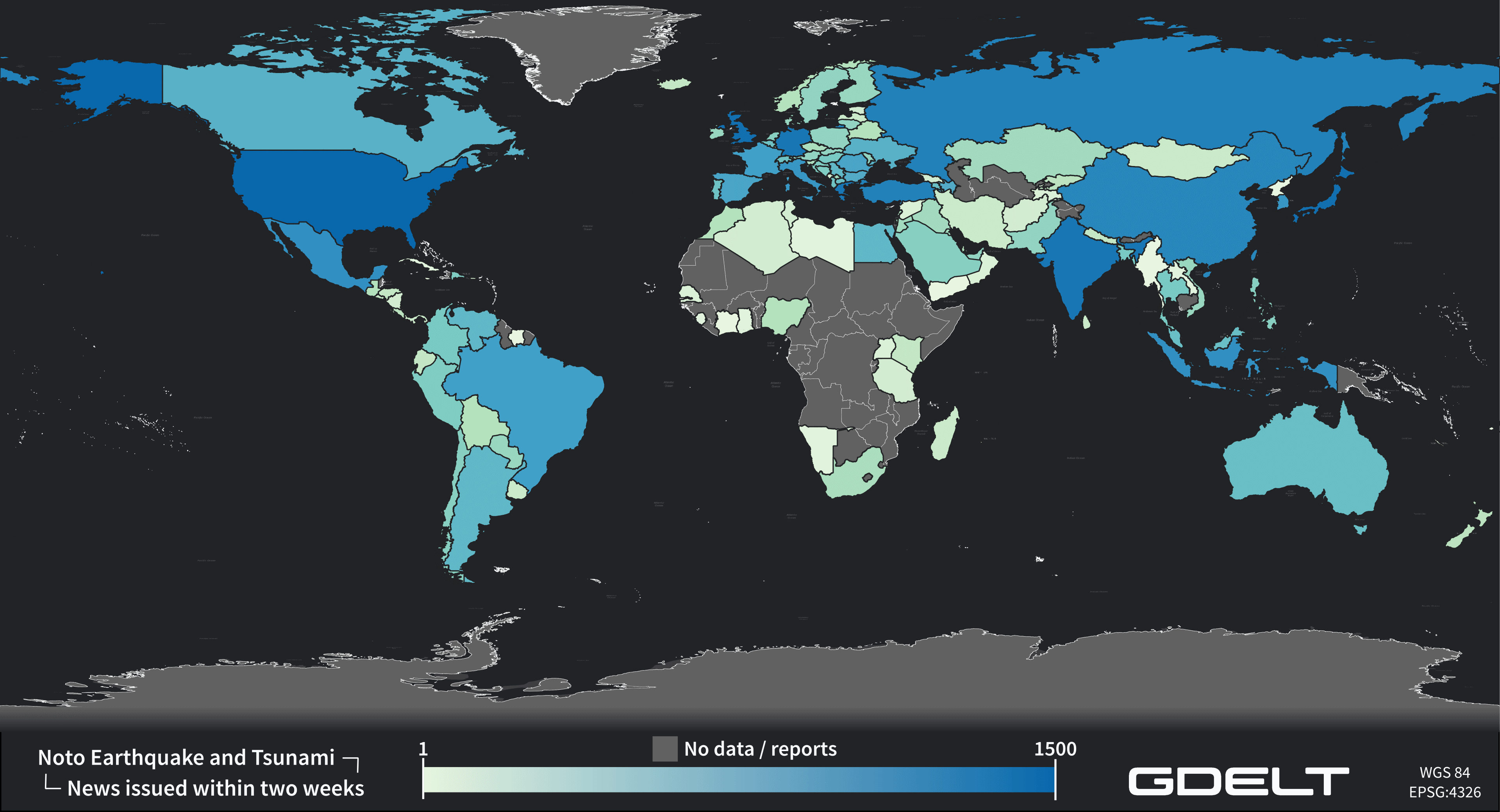
On Tuesday, April 30 Konstantin Müller will present his internship ” GDELT News Analysis of the Noto Earthquake via ERNIE” at 14:00 in 01.B.03, John-Skilton-Str. 4a. :
From the abstract: The analysis of socioeconomic data has gained increasing importance. The exchange of information, particularly through news agencies and magazines, shapes public perception and guides daily decision-making. This process is further amplified during significant events like natural disasters. The International Research Institute of Disaster Science (IRIDeS) focuses on investigating not only the environmental aspects of disasters but also their societal impacts, both locally and globally. In collaboration with IRIDeS, this internship explores the potential of utilizing a self-built pipeline named ERNIE to model and analyze the global social data source, GDELT. ERNIE facilitates the efficient integration of GDELT data relevant to IRIDeS’ field of expertise – particularly natural disasters – for future projects. Subsequently, the constructed pipeline is employed to analyze the publicly available GDELT news data pertaining to the Noto Peninsula Earthquake in Japan, which struck on January 1st.
Supervisor: Prof. Dr. Hannes Taubenböck
Hosting Institution: International Research Institute of Disaster Science (IRIDeS)

you may also like:

Successful Master’s thesis defense by Prince Lartey Lawson

Successful Master’s thesis defense by Prince Lartey Lawson

Our EAGLE Prince Lartey Lawson successfully defended his Master's thesis today (April 30th) titled "" Unmasking the Shadow Economy in Ghana: Mapping the Distribution of Umbrella Covered Informal Vendors In Kumasi". From the abstract of his thesis: Informal trade in...

Spatial Earth Observation R packages by our EAGLEs

Spatial Earth Observation R packages by our EAGLEs

Our EAGLE students that took and passed our Introduction to spatial programming course had to submit an R package that applies spatial methods for a variety of Earth Observation data. We are very proud to show the huge diversity of very interesting and useful R...

cooperative project with DLR ZKI

cooperative project with DLR ZKI

In cooperation with the DLR ZKI did we conduct drone flights last week using Lidar and oblique sensors in order to provide valuable landscape information for autonomous vehicle navigation. Within the project the feasibility to map unknown areas and its accessibility...

Object oriented image classification course

Object oriented image classification course

Today our EAGLE object based image analysis (OBIA) started, taught by our colleague Dr Michael Wurm, team leader at the DLR Earth Observation center GZS department.  Michael is covering the theory and practice of OBIA in his class and thereby broadening the...