LaVaCCA Introductory GIS / R course in Almaty, Kazakhstan

LaVaCCA Introductory GIS / R course in Almaty, Kazakhstan

April 27, 2015

LaVaCCA_Project_Logo

Logo of the LaVaCCA project

After the kick-off meeting of the Volkswagen Foundation funded LaVaCCA project in Almaty (see post), an intensive R/GIS training was held in the GIS lab of the Al ́Farabi Kazakh National University, organized and led by staffers from the Department of Remote Sensing, Würzburg University. Young scientific staffers, post-docs and PhD students as well as invited guests from SIC-ICWC, Al´Farabi University and CAREC joined the training course from February 12th to 17th 2015.

The focus of the course was on methods and techniques for the application of satellite remote sensing in agricultural management, including the use of the statistical and open source programming language R:


  • Introduction to the statistical software R
  • Spatial statistics in R
  • Working with vector data in R
  • Working with raster data in R
  • Visualizing and manipulating satellite data in R

This course served as a preparatory course for another, intensive training to be held in Urgench, Uzbekistan, in summer 2015. The feedback from the participants for the first course in Almaty was very positive and participants were given the opportunity to propose the topics and schedule of the second course in Urgench, Uzbekistan in summer 2015.

More information on the LaVaCCA project can be found here. Information on the R project for statistical computing, including download links can be found here.

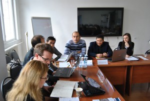
GIS/R_training_LaVaCCA

Participants of the LaVaCCA R/GIS course in Almaty, Kazakhstan


you may also like:

Meeting with majors and local stakeholders within EO4CAM project

Meeting with majors and local stakeholders within EO4CAM project

On Wednesday, 30 October, a delegation from the EO4CAM project (comprising three members of the EORC and one from the ZKI, DLR) visited the small town of Markt Burgheim in Bavaria. They joined a meeting of local authorities and other stakeholders to discuss strategies...

social bouldering event

social bouldering event

Last Friday did we organize again a social event for all staff members and EAGLEs to get to know the new students, meet and chat with old students and just have a nice time outside the office for all staff members. We spend 4 hours together in the Rock In boulder gym...

snow cover conditions at Zugspitze with UAS sensors

snow cover conditions at Zugspitze with UAS sensors

Our UAS team travelled to Umweltforschungsstation Schneefernerhaus at Zugspitze to continue the time-series analysis for landscape analysis using drones. At an average elevation of 2500 meters, the team, Luisa Pflumm, Baturalp Arisoy, Konstantin Müller and Basil...

Guest lecture at KonGeoS conference

Guest lecture at KonGeoS conference

The KonGeoS conference (24-27.10.2024 in Würzburg) of geodesy student councils in Germany, Switzerland and Austria invited our Professor Hannes Taubenböck to give a guest lecture. On 25 October 2024, he gave a lecture on settlement development in Germany and discussed...

OPTIPLAN – Driving Innovation in Traffic and Urban Planning

OPTIPLAN – Driving Innovation in Traffic and Urban Planning

Driving Innovation in Traffic and Urban Planning: Insights from OPTIPLAN On October 24, 2024, the OPTIPLAN research consortium (German Aerospace Center (DLR)/University of Würzburg, Ingenieurbüro Behringer & Partner, and OBERMEYER GmbH) gathered to advance...