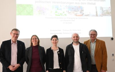
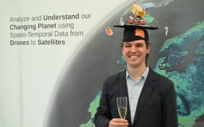
Congratulations to Maninder for submitting his PhD dissertation to the Graduate School of Science and Technology (GSST). This dissertation explores the potential of remote sensing (RS) data and crop growth models (CGMs) in accurately predicting long-term crop yields of winter wheat (WW) and oil seed rape (OSR) for the Free State of Bavaria, Germany. The study shows that RS data can provide valuable information for yield assessment by monitoring crop development, detecting crop changes, and assessing the impact of climate change on crop yields. The use of synthetic spatiotemporal datasets obtained through RS and CGMs, such as the simple light use efficiency (LUE) model, can accurately map and monitor crop yields at a regional scale. The research also shows that coupling the LUE model with the random forest (RF) model can further improve yield predictions. The study also discusses the impact of land use diversity on crop yields and suggests the scope of new sensors and artificial intelligence in achieving more accurate crop yield predictions.
His supervisors are Prof. Dr Tobias Ullmann (EORhub), Prof. Dr Ingolf Stephan-Dewenter (Biology), Prof. Dr Andrea Hlozschuh (Biology), and Prof. Dr Andreas Nüchter (Informatics).
Below is the summary of my dissertation-
Accurate crop monitoring in response to climate change at a regional or field scale plays a significant role in developing agricultural policies, improving food security, forecasting, and analysing global trade trends. Climate change is expected to significantly impact agriculture, with shifts in temperature, precipitation patterns, and extreme weather events negatively affecting crop yields, soil fertility, water availability, biodiversity, and crop growing conditions. Remote sensing (RS) can provide valuable information combined with crop growth models (CGMs) for yield assessment by monitoring crop development, detecting crop changes, and assessing the impact of climate change on crop yields. This dissertation aims to investigate the potential of RS data on modelling long-term crop yields of winter wheat (WW) and oil seed rape (OSR) for the Free State of Bavaria (70,550 km 2 ), Germany. The first chapter of the dissertation describes the reasons favouring the importance of accurate crop yield predictions for achieving sustainability in agriculture. Chapter second explores the accuracy assessment of the synthetic RS data by fusing NDVIs of two high spatial resolution data (high pair) (Landsat (30 m, 16-days; L) and Sentinel-2 (10 m, 5–6 days; S), with four low spatial resolution data (low pair) (MOD13Q1 (250 m, 16-days), MCD43A4 (500 m, one day), MOD09GQ (250 m, one-day), and MOD09Q1 (250 m, 8- days)) using the spatial and temporal adaptive reflectance fusion model (STARFM), which fills regions’ cloud or shadow gaps without losing spatial information. The chapter finds that both L-MOD13Q1 (R2 = 0.62, RMSE = 0.11) and S-MOD13Q1 (R2 = 0.68, RMSE = 0.13) are more suitable for agricultural monitoring than the other synthetic products fused. Chapter third explores the ability of the synthetic spatiotemporal datasets (obtained in chapter 2) to accurately map and monitor crop yields of WW and OSR at a regional scale. The chapter investigates and discusses the optimal spatial (10 m, 30 m, or 250 m), temporal (8 or 16-day) and CGMs (World Food Studies (WOFOST), and the semi-empiric light use efficiency approach (LUE)) for accurate crop yield estimations of both crop types. Chapter third observes that the observations of high temporal resolution (8-day) products of both S-MOD13Q1 and L- MOD13Q1 play a significant role in accurately measuring the yield of WW and OSR. The chapter investigates that the simple light use efficiency (LUE) model (R2 = 0.77 and relative RMSE (RRMSE) = 8.17%) that required fewer input parameters to simulate crop yield is highly accurate, reliable, and more precise than the complex WOFOST model (R2 = 0.66 and RRMSE = 11.35%) with higher input parameters. Chapter four researches the relationship of spatiotemporal fusion modelling using STRAFM on crop yield prediction for WW and OSR using the LUE model for Bavaria from 2001 to 2019. The chapter states the high positive correlation coefficient (R) = 0.81 and R = 0.77 between the yearly R 2 of synthetic accuracy and modelled yield accuracy for WW and OSR from 2001 to 2019, respectively. The chapter analyses the impact of climate variables on crop yield predictions by observing an increase in R2 (0.79 (WW)/0.86 (OSR)) and a decrease in RMSE (4.51/2.57 dt/ha) when the climate effect is included in the model. The fifth chapter suggests that the coupling of the LUE model to the random forest (RF) model can further reduce the relative root mean square error (RRMSE) from -8% (WW) and -1.6% (OSR) and increase the R2 by 14.3% (for both WW and OSR), compared to results just relying on LUE. The same chapter concludes that satellite-based crop biomass, solar radiation, and temperature are the most influential variables in the yield prediction of both crop types. Chapter six attempts to discuss both pros and cons of RS technology while analysing the impact of land use diversity on crop-modelled biomass of WW and OSR. The chapter finds that the modelled biomass of both crops is positively impacted by land use diversity to the radius of 450 (Shannon Diversity Index ~0.75) and 1050 m (~0.75), respectively. The chapter also discusses the future implications by stating that including some dependent factors (such as the management practices used, soil health, pest management, and pollinators) could improve the relationship of RS-modelled crop yields with biodiversity. Lastly, chapter seven discusses testing the scope of new sensors such as unmanned aerial vehicles, hyperspectral sensors, or Sentinel-1 SAR in RS for achieving accurate crop yield predictions for precision farming. In addition, the chapter highlights the significance of artificial intelligence (AI) or deep learning (DL) in obtaining higher crop yield accuracies.