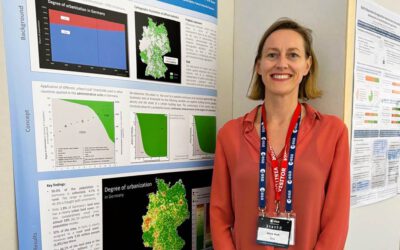
Matthias Weigand defended his PhD Thesis titled “Fernerkundung und maschinelles Lernen zur Erfassung von urbanem Grün – Eine Analyse am Beispiel der Verteilungsgerechtigkeit in Deutschland ” [english: Remote sensing and machine learning to capture urban greenery – An analysis using the example of distributive justice in Germany] at the Julius-Maximilians-University Würzburg successfully on the 13th of December 2023.
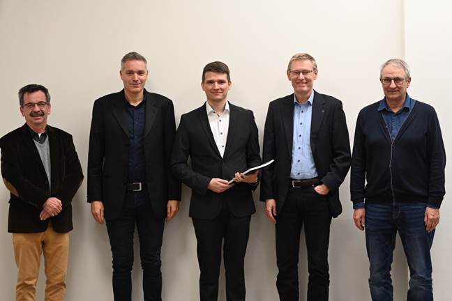
The Earth Observation Research Cluster congratulates him very much for his achievements in the research fields of remote sensing and urban green. The defense was led by Prof. Helmut Flachenecker and Matthias was supervised by Prof. Stefan Dech (DLR/JMU), Prof. Hannes Taubenböck (DLR/JMU) and Prof. Jürgen Rauh (JMU). His mentor at the German Remote Sensing Data Center (DFD) of the German Aerospace Center (DLR) was Dr. Michael Wurm.
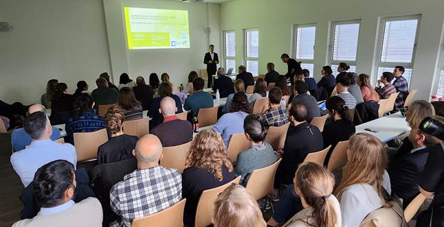
It was the first defense in our new building at John Skilton Str. 4a and we were very happy to welcome a large audience from the German Aerospace Center (DLR), the University of Würzburg and friends and family of the PhD candidate.
Here is the abstract of his PhD thesis:
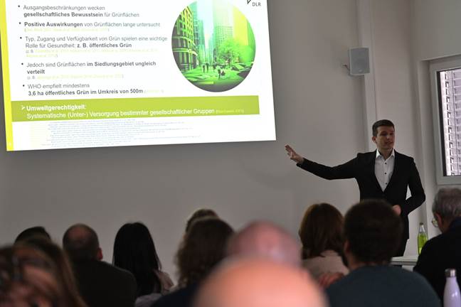
Green spaces are one of the most important environmental factors for humans in the living environment. On the one hand they provide benefits to people’s physical and mental health, on the other hand they allow for the mitigation of negative impacts of environmental stressors like heat waves which are increasing as a result of climate change. Yet, green spaces are not equally accessible to all people. Existing literature in the context of Environmental Justice (EJ) research has shown that the access to green space varies among different socio-economic and demographic groups in Germany. However, previous studies in the context of EJ were criticized for using strongly spatially aggregated data for their analyses resulting in a loss of spatial detail on local environmental exposure metrics. This is especially true for large-scale studies where important spatial information often get lost. In this context, modern earth observation and geospatial data are more detailed than ever, and machine learning methods enable efficient processing to derive higher value information for diverse applications.
The overall objective of this work is to demonstrate and implement methodological steps that allow for the transformation of vast geodata into relevant geoinformation for the large-scale and high-resolution analysis of environmental characteristics using the example of green spaces in Germany. By bridging the disciplines remote sensing, geoinformatics, social geography and environmental justice research, potentials of modern methods for the improvement of spatial and semantic resolution of geoinformation are explored. For this purpose, machine learning methods are used to map land cover and land use on a national scale. These developments will help to close existing data gaps and provide information on the distributional equity of green spaces.
This dissertation comprises three conceptual steps. In the first part of the study, earth observation data from the Sentinel-2 satellites are used to derive land cover information across Germany. In combination with point reference data on land cover and land use from the paneuropean Land Use and Coverage Area Frame Survey (LUCAS) a machine learning model is trained. Therein, different preprocessing steps of the LUCAS data and their influence on the classification accuracy are highlighted. The classification model derives land cover information with high accuracy even in complex urban areas. One result of the study is a Germany-wide land cover classification with an overall accuracy of 93.07 % which is used in the further course of the dissertation to spatially quantify green land cover (GLC).
The second conceptual part of this study focuses on the semantic differentiation of green spaces using the example of public green spaces (PGS), which is often the subject of EJ research. A frequently used source of spatial data on public green spaces, the European Urban Atlas (EUA), however, is not available for all of Germany. This part of the study takes a data-driven approach to determine the availability of public green space at the spatial level of neighborhoods for all of Germany. For this purpose, areas already covered by the EUA serve as a reference. Using a combination of earth observation data and information from the OpenStreetMap project, a Deep Learning-based fusion network is created that quantifies the available area of public green space. The result of this step is a model that is utilized to estimate the amount of public green space in the neighborhood (𝑅2 = 0.952).
The third part of this dissertation builds upon the results of the first two parts and integrates georeferenced population data to study the socio-spatial distribution of green spaces in Germany. This exemplary analysis distinguishes green spaces according to two types: GLC and PGS. In this, first, descriptive statistics are used to examine the overall distribution of green spaces available to the German population. Then, the distributional equality is determined using established equality metrics. Finally, the relationships between the demographic composition of the neighborhood and the available amount of green space are examined using three exemplary sociodemographic groups. The analysis reveals strong differences in PGS availability between urban and rural areas. Compared to the rural population, a higher percentage of the urban population has access to the minimum level of PGS defined as a target by the World Health Organization (WHO). The results also show a clear deviation in terms of distributive equality between GLC and PGS, highlighting the relevance of distinguishing green space types for such studies. The final analysis of certain population groups addresses differences at the sociodemographic level.
In summary, this dissertation demonstrates how previous limitations of spatial datasets can be overcome through a combination of modern geospatial data and machine learning methods. Using the example of green spaces in the residential environment of the population in Germany, it is shown that nationwide analyses of environmental justice can be enriched by high-resolution and locally fine-grained geographic information. This study illustrates how earth observation and methods of geoinformatics can make an important contribution to identifying inequalities in people’s living environment. Such objective information can ultimately be deployed to support and monitor sustainable urban development.