new article: Adding structure to land cover – using fractional cover to study animal habitat selection

new article: Adding structure to land cover – using fractional cover to study animal habitat selection

December 30, 2014

our new article just got published online in “Movement Ecology” on the added value of fractional cover analysis using remote sensing data to explain spatio-temporal animal movement patterns. More in-depth analysis are needed to compare and evaluate the importance of different remote sensing derived parameters for this kind of analysis.

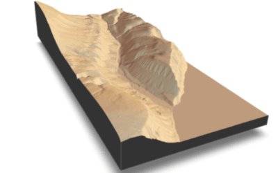
Linking animal movements to landscape features is critical to identify factors that shape the spatial behaviour of animals. Habitat selection is led by behavioural decisions and is shaped by the environment, therefore the landscape is crucial for the analysis. Land cover classification based on ground survey and remote sensing data sets are an established approach to define landscapes for habitat selection analysis.We investigate an approach for analysing habitat use using continuous land cover information and spatial metrics. This approach uses a continuous representation of the landscape using percentage cover of a chosen land cover type instead of discrete classes. This approach, fractional cover, captures spatial heterogeneity within classes and is therefore capable to provide a more distinct representation of the landscape. The variation in home range sizes is analysed using fractional cover and spatial metrics in conjunction with mixed effect models on red deer position data in the Bohemian Forest, compared over multiple spatio?temporal scales.resized_forest_hymap_model_NZ
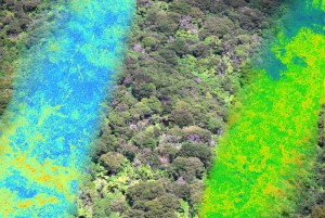
We analysed forest fractional cover and a texture metric within each home range showing that variance of fractional cover values and texture explain much of variation in home range sizes. The results show a hump?shaped relationship, leading to smaller home ranges when forest fractional cover is very homogeneous or highly heterogeneous, while intermediate stages lead to larger home ranges.

The application of continuous land cover information in conjunction with spatial metrics proved to be valuable for the explanation of home-range sizes of red deer.


Mirjana Bevanda, Ned Horning, Bjoern Reineking, Marco Heurich, Martin Wegmann and Joerg Mueller

Adding structure to land cover – using fractional cover to study animal habitat selection

Movement Ecology 2014, 2:26

http://www.movementecologyjournal.com/content/2/1/26/abstract

you may also like:

Our research site and project covered by BR

Our research site and project covered by BR

The University forest at Sailershausen is a unique forest owned by the University of Wuerzburg. It comes with a high diversity of trees and most important is part of various research projects. We conducted various UAS/UAV/drone flights with Lidar, multispectral and...

Meeting of the FluBig Project Team

Meeting of the FluBig Project Team

During the last two days, the team of the FluBig project (remote-sensing.org/new-dfg-project-on-fluvial-research/) met at the EORC for discussing the ongoing work on fluvial biogeomorphology. After returning from a successful field expedition to Kyrgyzstan a couple of...

‘Super Test Site Würzburg’ project meeting

‘Super Test Site Würzburg’ project meeting

After the successful "Super Test Site Würzburg" measurement campaign in June (please see here: https://remote-sensing.org/super-test-site-wurzburg-from-the-idea-to-realization/ ), the core team from the University of Würzburg, the Karlsruhe Institute of Technology,...

EORC Talk: Geolingual Studies: A New Research Direction

EORC Talk: Geolingual Studies: A New Research Direction

On July 19th, Lisa Lehnen and Richard Lemoine Rodríguez, two postdoctoral researchers of the Geolingual Studies project, gave an inspiring presentation at the EORC talk series.   In the talk titled "Geolingual Studies – a new research direction", they...

EO support for UrbanPArt field work

EO support for UrbanPArt field work

From May to September, Karla Wenner, a PhD student at the Juniorprofessorship for Applied Biodiversity Science, will be sampling urban green spaces and semi-natural grasslands in Würzburg as part of the UrbanPArt project. Our cargo bikes support the research project...

Cinematic drone shots

Cinematic drone shots

We spend quite some time in the field conducting field work, from lidar measurements to vegetation samples in order to correlate it with remote sensing data to answer various research questions concerning global change. Field work is always a 24/7 work load and...