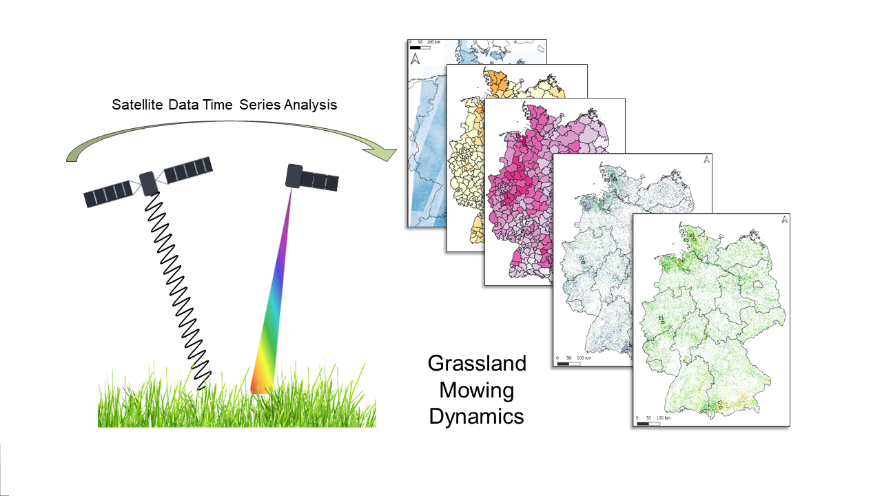
Our PhD student Sophie Reinermann published her work “Detection of Grassland Mowing Events for Germany by Combining Sentinel-1 and Sentinel-2 Time Serie” in Remote Sensing. From the abstract: “Grasslands cover one-third of the agricultural area in Germany and play an important economic role by providing fodder for livestock. In addition, they fulfill important ecosystem services, such as carbon storage, water purification, and the provision of habitats. These ecosystem services usually depend on the grassland management. In central Europe, grasslands are grazed and/or mown, whereby the management type and intensity vary in space and time. Spatial information on the mowing timing and frequency on larger scales are usually not available but would be required in order to assess the ecosystem services, species composition, and grassland yields. Time series of high-resolution satellite remote sensing data can be used to analyze the temporal and spatial dynamics of grasslands. Within this study, we aim to overcome the drawbacks identified by previous studies, such as optical data availability and the lack of comprehensive reference data, by testing the time series of various Sentinel-2 (S2) and Sentinal-1 (S1) parameters and combinations of them in order to detect mowing events in Germany in 2019. We developed a threshold-based algorithm by using information from a comprehensive reference dataset of heterogeneously managed grassland parcels in Germany, obtained by RGB cameras. The developed approach using the enhanced vegetation index (EVI) derived from S2 led to a successful mowing event detection in Germany (60.3% of mowing events detected, F1-Score = 0.64). However, events shortly before, during, or shortly after cloud gaps were missed and in regions with lower S2 orbit coverage fewer mowing events were detected. Therefore, S1-based backscatter, InSAR, and PolSAR features were investigated during S2 data gaps. From these, the PolSAR entropy detected mowing events most reliably. For a focus region, we tested an integrated approach by combining S2 and S1 parameters. This approach detected additional mowing events, but also led to many false positive events, resulting in a reduction in the F1-Score (from 0.65 of S2 to 0.61 of S2 + S1 for the focus region). According to our analysis, a majority of grasslands in Germany are only mown zero to two times (around 84%) and are probably additionally used for grazing. A small proportion is mown more often than four times (3%). Regions with a generally higher grassland mowing frequency are located in southern, south-eastern, and northern Germany.”
read the full article here:
Reinermann, S.; Gessner, U.; Asam, S.; Ullmann, T.; Schucknecht, A.; Kuenzer, C. Detection of Grassland Mowing Events for Germany by Combining Sentinel-1 and Sentinel-2 Time Series. Remote Sens. 2022, 14, 1647. https://doi.org/10.3390/rs14071647

