A new paper was published in Forstliche Forschungsberichte München poublished by TU München which summarizes a series of studies leading to the first forest inventory based completely on processing LiDAR and aerial imagery data in Bavarian Forest National Park in Germany. The main focus is on deriving biometric forest structural variables by single tree- and area-based methods. By processing full waveform LiDAR data, more tha 13 million single trees were identified, which were further modelled to derive height, crone volume, crown base height, tree type group, deadwood, standing volume and diameter at breat height. comparison of area-based and single tree-based methods further validated the method. The research on this topic is currently ongoing and will be practically implemented by the BFNP administration in tis future inventory campaigns.
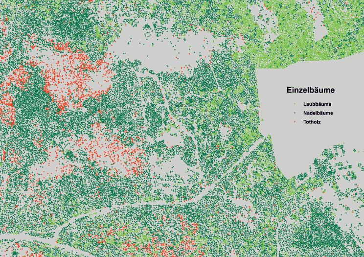
On the basis of lidar the distribution of single living and death can be mapped for the national park (a figure from the publication)
Source:
Heurich, M., Krzystek, P., Polakowski, F., Latifi, H., Krauss, A., and Müller, J. (2015) Erste Waldinventur auf Basis von Lidardaten und digitalen Luftbildern im Nationalpark Bayerischer Wald, Forstliche Forschungsberichte München 2015, 101-103.