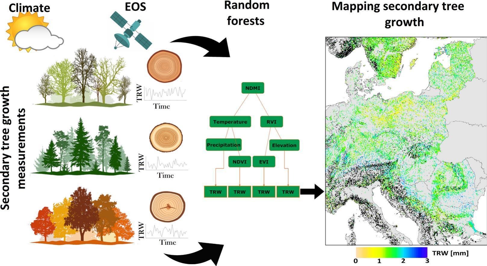
The Earth Observation Research Cluster (EORC) just contributed to a new paper titled “Incorporating high-resolution climate, remote sensing and topographic data to map annual forest growth in central and eastern Europe” in the Journal “Science of The Total Environment”.

From the abstract: To enhance our understanding of forest carbon sequestration, climate change mitigation and drought impact on forest ecosystems, the availability of high-resolution annual forest growth maps based on tree-ring width (TRW) would provide a significant advancement to the field. Site-specific characteristics, which can be approximated by high-resolution Earth observation by satellites (EOS), emerge as crucial drivers of forest growth, influencing how climate translates into tree growth. EOS provides information on surface reflectance related to forest characteristics and thus can potentially improve the accuracy of forest growth models based on TRW. Through the modelling of TRW using EOS, climate and topography data, we showed that species-specific models can explain up to 52 % of model variance (Quercus petraea), while combining different species results in relatively poor model performance (R2 = 13 %). The integration of EOS into models based solely on climate and elevation data improved the explained variance by 6 % on average. Leveraging these insights, we successfully generated a map of annual TRW for the year 2021. We employed the area of applicability (AOA) approach to delineate the range in which our models are deemed valid. The calculated AOA for the established forest-type models was 73 % of the study region, indicating robust spatial applicability. Notably, unreliable predictions predominantly occurred in the climate margins of our dataset. In conclusion, our large-scale assessment underscores the efficacy of combining climate, EOS and topographic data to develop robust models for mapping annual TRW. This research not only fills a critical void in the current understanding of forest growth dynamics but also highlights the potential of integrated data sources for comprehensive ecosystem assessments.
Access to the full article: https://doi.org/10.1016/j.scitotenv.2023.169692

