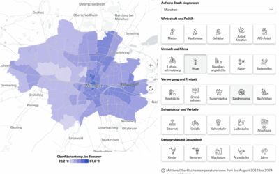
Researchers from the Earth Observation Center (EOC) of the German Aerospace Center (DLR) in Oberpfaffenhofen, the Professorship of Social Geography of the Julius-Maximillians-University Würzburg, and our Earth Observation Research Cluster of the University of Würzburg teamed up for a study on analysing neighborhood-level green space availability in Germany.
The paper titled “Are public green spaces distributed fairly? A nationwide analysis based on remote sensing, OpenStreetMap and census data” was just published Open Access in the journal Geocarto International by Matthias Weigand, Michael Wurm, Ariane Droin, Thomas Stark, Jeroen Staab, Jürgen Rauh, and Hannes Taubenböck.
Abstract:
Green space (GS) is an important resource in the urban environment. Yet, there are significant spatial and social disparities in the availability of GS. In this study, we compare the availability of GS on a national scale using green land cover (GLC) and public green space (PGS). We use two GS datasets in conjunction with spatial census data to analyse GS availability and accessibility for the German population using descriptive statistics and mixed effects models. We show that the average GS availability differs by a factor of three between GLC and PGS. 19.2 % of the people in Germany find less than the WHO defined target of 3.6 hectares of PGS in their neighbourhood. PGS is less equally distributed among the population than GLC and green space equity varies significantly between rural and urban areas. In areas with multi-family homes, a higher share of the population has access to sufficient PGS than in areas with predominantly single-family homes. We find a negative relation between GLC availability and share of immigrant population which does not extend to PGS.
Green space (GS) is an important resource in the urban environment. Yet, there are significant spatial and social disparities in the availability of GS. In this study, we compare the availability of GS on a national scale using green land cover (GLC) and public green space (PGS). We use two GS datasets in conjunction with spatial census data to analyse GS availability and accessibility for the German population using descriptive statistics and mixed effects models. We show that the average GS availability differs by a factor of three between GLC and PGS. 19.2 % of the people in Germany find less than the WHO defined target of 3.6 hectares of PGS in their neighbourhood. PGS is less equally distributed among the population than GLC and green space equity varies significantly between rural and urban areas. In areas with multi-family homes, a higher share of the population has access to sufficient PGS than in areas with predominantly single-family homes. We find a negative relation between GLC availability and share of immigrant population which does not extend to PGS.
The full paper can be found at: http://dx.doi.org/10.1080/10106049.2023.2286305
This paper is related to other studies of the team on the topic of “urban green”. Here are some examples:
- Spatially-optimized urban greening for reduction of population exposure to land surface temperature extremes – https://www.nature.com/articles/s41467-023-38596-1
- Does urbanization mean a loss of greenspace? A multi-temporal analysis for Chinese cities – https://www.sciencedirect.com/science/article/abs/pii/S0048969723049987
- Which city is the greenest? A multi-dimensional deconstruction of city rankings – https://www.sciencedirect.com/science/article/pii/S0198971521000946
- Urban Trees in Munich – Detection, Delineation, Quantification, and Characterization based on VHR Remote Sensing data – https://repository.corp.at/829/