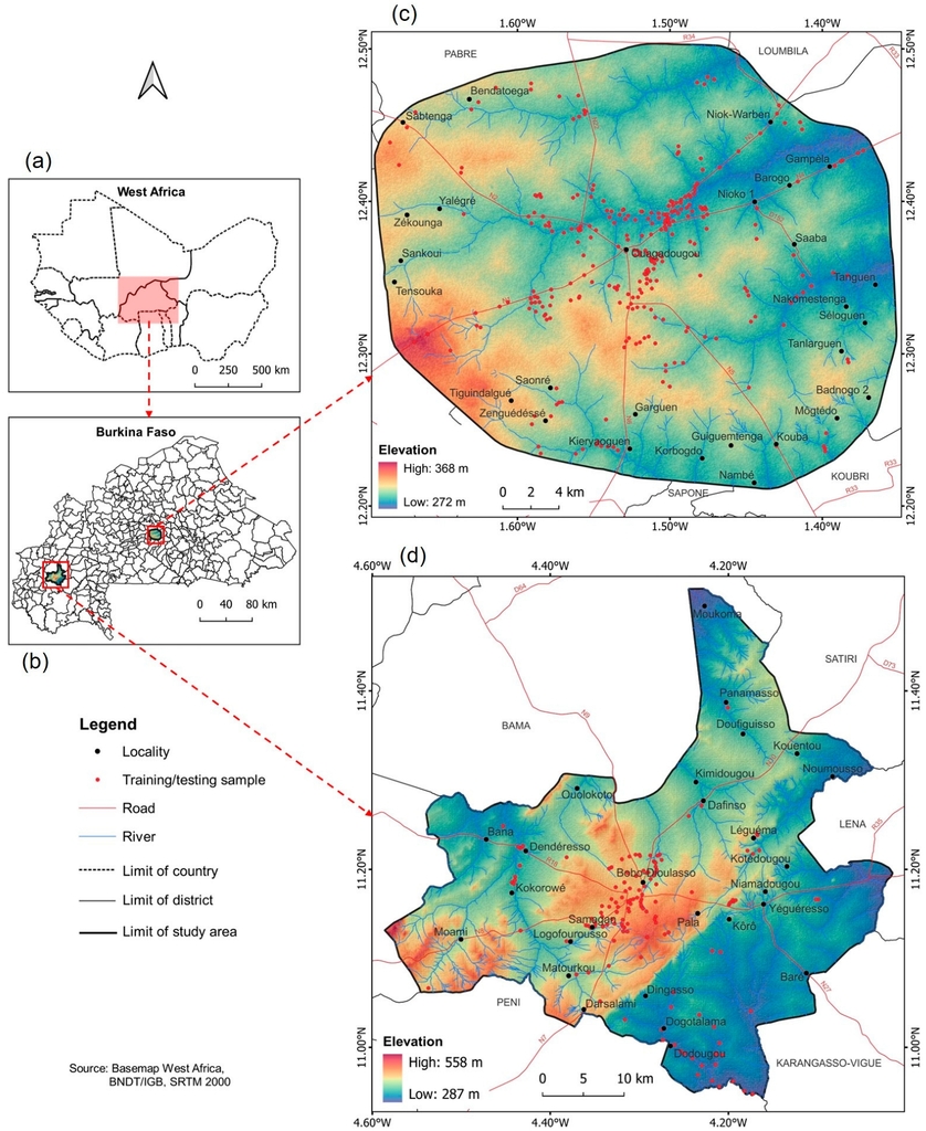
Last year’s guest researcher Valentin Ouedraogo published his first publication in the context of his doctoral thesis. The title of the article is “Intensity Analysis for Urban Land Use/Land Cover Dynamics Characterization of Ouagadougou and Bobo-Dioulasso in Burkina Faso”.
From the abstract: Ouagadougou and Bobo-Dioulasso remain the two major urban centers in Burkina Faso with an increasing trend in human footprint. The research aimed at analyzing the Land Use/Land Cover (LULC) dynamics in the two cities between 2003 and 2021 using intensity analysis, which decomposes LULC changes into interval, category and transition levels. The satellite data used for this research were composed of surface reflectance imagery from Landsat 5, Landsat 7 and Landsat 8 acquired from the Google Earth Engine Data Catalogue. The Random Forest, Support Vector Machine and Gradient Tree Boost algorithms were employed to run supervised image classifications for four selected years including 2003, 2009, 2015 and 2021. The results showed that the landscape is changing in both cities due to rapid urbanization. Ouagadougou experienced more rapid changes than Bobo-Dioulasso, with a maximum annual change intensity of 3.61% recorded between 2015 and 2021 against 2.22% in Bobo-Dioulasso for the period 2009–2015. The transition of change was mainly towards built-up areas, which gain targeted bare and agricultural lands in both cities. This situation has led to a 78.12% increase of built-up surfaces in Ouagadougou, while 42.24% of agricultural land area was lost. However, in Bobo-Dioulasso, the built class has increased far more by 140.67%, and the agricultural land areas experienced a gain of 1.38% compared with the 2003 baseline. The study demonstrates that the human footprint is increasing in both cities making the inhabitants vulnerable
to environmental threats such as flooding and the effect of an Urban Heat Island, which is information that could serve as guide for sustainable urban land use planning.

