
New publication on the potential of predicting income inequality and income levels from attributes of the built, natural and social environment in Germany
Researchers from the ifo Institute – Leibniz Institute for Economic Research at the University of Munich, the German Remote Sensing Data Center (DFD) of the German Aerospace Center (DLR), the Ludwig-Maximilians-University of Munich (LMU), the University of Bristol and our Earth Observation Research Cluster of the Julius-Maximilians University Würzburg (JMU) teamed up for a study on predicting income inequality and income levels from attributes of the built, natural and social environment in Germany. The paper titled “Learning income levels and inequality from spatial and sociodemographic data in Germany” was just published in the journal Applied Geography by Oana M. Garbasevschi, Hannes Taubenböck, Paul Schüle, Julia Baarck, Paul Hufe, Michael Wurm and Andreas Peichl. The work is based on the interdisciplinary cooperation of economics, spatial sciences and remote sensing. The full article is available here: https://www.sciencedirect.com/science/article/pii/S0143622823001893
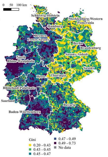
And here is the Abstract of the article: This study explores the potential of predicting income inequality and income levels from attributes of the built, natural and social environment in Germany. Furthermore, it investigates differences in explanatory variables and estimation accuracy for municipalities with different social and spatial structure profiles. We use income tax data, the 2011 national census, and spatial data from various sources. The explanatory variables capture the spatial variation within the area of interest of characteristics of both the residents and the living environment. Our models explain 54% of the variability in inequality and 73% of the variability in median income levels for a sample of municipalities covering 97% of the country’s population. Performance increases for the subsample of municipalities with at least 10,000 inhabitants, attaining 63% for inequality and 80% for income levels. Income inequality and top incomes are better identified in Western, urban, or central locations, while median income is best estimated in Eastern, rural and peripheral locations. The most important predictors are derived from attributes such as nationality, religious affiliation, household composition, residence construction year, as well as the size and density of residences and overall building stock. Our findings further the idea that the joint spatial analysis of population and the built environment can greatly improve our understanding of socioeconomic phenomena—at regional and local levels—beyond conventional data sources.