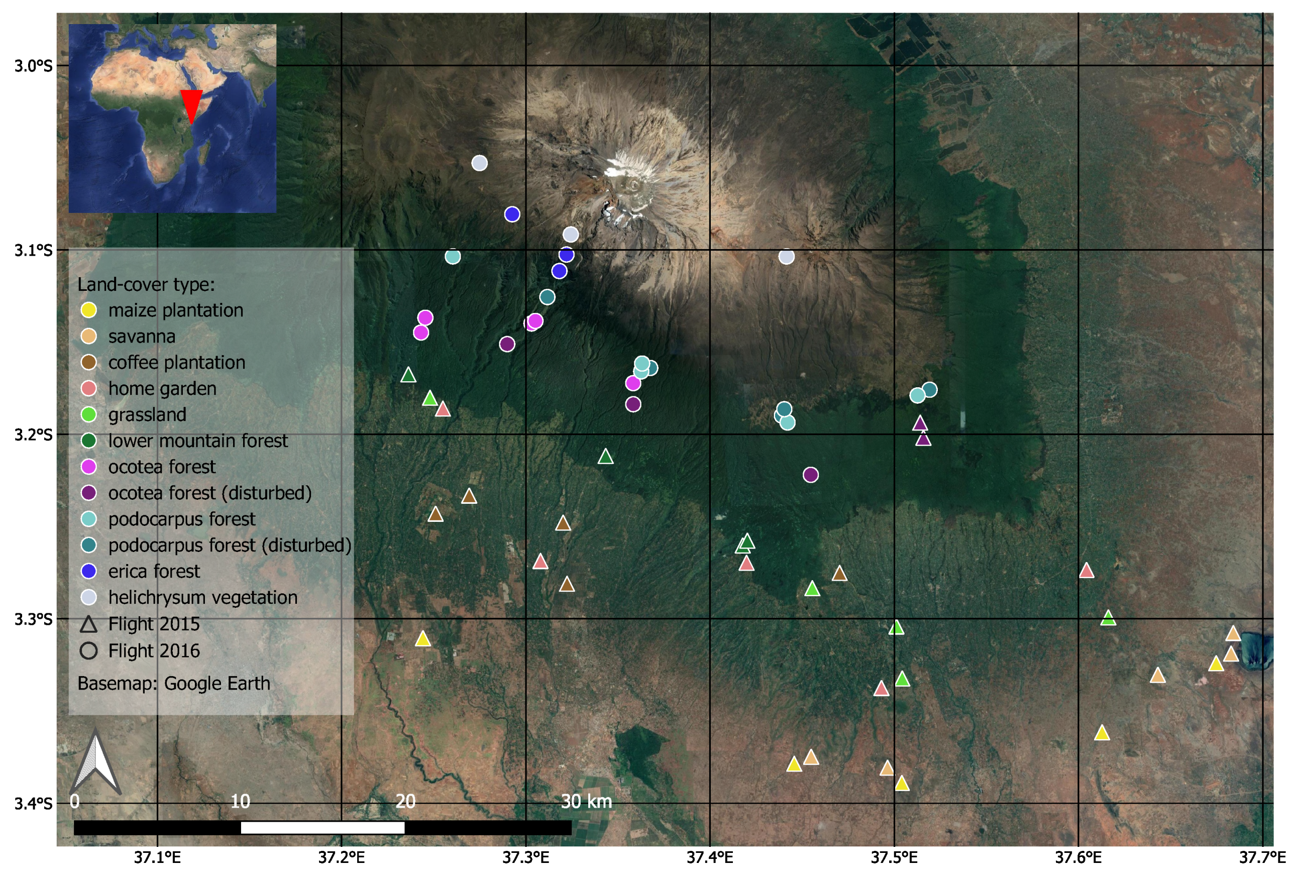
We are glad to share with you our newest publication on “Potential of Airborne LiDAR Derived Vegetation Structure for the Prediction of Animal Species Richness at Mount Kilimanjaro ” in the open-access journal Remote Sensing by MDPI.
From the abstract: The monitoring of species and functional diversity is of increasing relevance for the development of strategies for the conservation and management of biodiversity. Therefore, reliable estimates of the performance of monitoring techniques across taxa become important. Using a unique dataset, this study investigates the potential of airborne LiDAR-derived variables characterizing vegetation structure as predictors for animal species richness at the southern slopes of Mount Kilimanjaro. To disentangle the structural LiDAR information from co-factors related to elevational vegetation zones, LiDAR-based models were compared to the predictive power of elevation models. 17 taxa and 4 feeding guilds were modeled and the standardized study design allowed for a comparison across the assemblages. Results show that most taxa (14) and feeding guilds (3) can be predicted best by elevation with normalized RMSE values but only for three of those taxa and two of those feeding guilds the difference to other models is significant. Generally, modeling performances between different models vary only slightly for each assemblage. For the remaining, structural information at most showed little additional contribution to the performance. In summary, LiDAR observations can be used for animal species prediction. However, the effort and cost of aerial surveys are not always in proportion with the prediction quality, especially when the species distribution follows zonal patterns, and elevation information yields similar results.
Full article: Ziegler A, Meyer H, Otte I, Peters MK, Appelhans T, Behler C, Böhning-Gaese K, Classen A, Detsch F, Deckert J, Eardley CD, Ferger SW, Fischer M, Gebert F, Haas M, Helbig-Bonitz M, Hemp A, Hemp C, Kakengi V, Mayr AV, Ngereza C, Reudenbach C, Röder J, Rutten G, Schellenberger Costa D, Schleuning M, Ssymank A, Steffan-Dewenter I, Tardanico J, Tschapka M, Vollstädt MGR, Wöllauer S, Zhang J, Brandl R, Nauss T. Potential of Airborne LiDAR Derived Vegetation Structure for the Prediction of Animal Species Richness at Mount Kilimanjaro. Remote Sensing. 2022; 14(3):786. https://doi.org/10.3390/rs14030786

