open position: PostDoc of Biophysical Parameters

open position: PostDoc of Biophysical Parameters

January 25, 2017


Postdoctoral Research Associate (TV-L E13)
Remote Sensing of Biophysical Parameters for Agricultural Monitoring
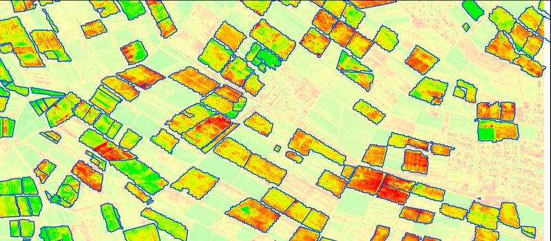
The Department of Remote Sensing, University of Würzburg, is looking for a motivated and team‐oriented fulltime (100%) Post-Doc research associate, starting from March2017 until August 2018.
The announced position is related to the project “Global Agricultural Monitoring. The German contribution”(GLAM.DE), which addresses the development of local, economically viable services in the field of agriculture. Scientific core objective is the development of innovative
methods for agricultural monitoring on the basis of high‐resolution missions (e.g., Sentinel). The project focuses on biomass and crop modelling as well as on monitoring of plant conditions and growth conditions, which are targeted by international activities such as GEOGLAM and Copernicus. Within the project we workclosely with the longstanding calibration and validation sites DEMMIN in Mecklenburg‐Western Pomerania. The partners involved in the project are the German Research Centre for Geosciences (GFZ), the German Aerospace Center (DLR) and green spin GmbH.
In case of mutual interest of the department and the successful candidate, a further career at the department is possible.
Our department:
The Department of Remote Sensing is based within an institutional cooperation with the DLR, especially with the German Remote Sensing Data Center (DFD). The research of the department focuseson remote sensing methods in the core fields of “sustainable land management”, “ecosystem functioning, and biodiversity”as well as“applied environmental modelling and forest inventory”. We are an ambitious team of young scientists at PhD and Post Doc level. We offer to work in a strong international network with numerous organizations in research and practice. To gain teaching experience we offer to contribute to our international MSc study programme in remote sensing and GIS (www.eagle‐science.org) andto our international MSc study programme Global Change Ecology at Bayreuth
University.
Requested fields of research and main tasks:
  • Coordination of the project GLAM.DE
  • communication and active design of implementation in cooperation with partners, including organization of workshops and project meetings,
  • Algorithm development for the derivation of vegetation parameters (biomass, LAI, FPAR, etc.) from optical and SAR remote sensing data,
  • Research on evaluation methods for agricultural satellite products within international activities (GEOGLAM) among others, in intensive cooperation with DEMMIN (http://demminweb.dlr.de/) and with the Joint Experiment for Crop Assessment and Monitoring (JECAM),
  • Work effectively as a researcher as part of a multi‐disciplinary national research team, to undertake independent scientific investigations and carry out/delegate associated tasks, and
  • Support in supervision of PhD, MSc, and BSc students in the context of the project.
Expected skills and competences
  • High‐quality doctoral degree (summa / magna cum laude or equivalent) in geography or related fields,
  • A sound knowledge in programming and remote sensing, experience in the processing of SAR (and optical) data as well as in data mining techniques,
  • Experience in international research, project management and project coordination is advantageous,
  • Successful publication history, particularly in peer reviewed refereed journals,
  • Excellent English skills (both written and spoken),
  • Good ability to represent the research team effectively internally and externally, including at conferences, and
  • Professional and respectful behaviour and attitude in a collaborative environment


The successful candidate will receive a position for 1.5years (TV-L E13). Please submit your application (in English or German) and including the reference number 2017/GLAM.DE) containing a cover letter, motivation letter (2 pages maximum), curriculum vitae with list of publications and project history, copies of diplomas, certificates or references from employers, by E-Mail to Prof. Dr. Christopher Conrad,  University of Würzburg: christopher.conrad@uni‐wuerzburg.de.

Further information:

Application must be submitted by February 6th 2017. For further information on the Department of Remote Sensing,candidates are encouraged to consult the department’s website http://www.geographie.uni‐wuerzburg.de/en/fernerkundung_neu/startseite/. The University of Würzburg is an equal opportunity employer that tries to increase the number of women in research and teaching. Applicants with disabilities but otherwise equal qualifications will be preferred.

you may also like:

New Team Member at the EORC: Sonja Mass

New Team Member at the EORC: Sonja Mass

Sonja Maas joined the Earth Observation Research Cluster (EORC) in October 2025 as a research assistant for the EO4CAM project. After finishing her bachelor's degree in forestry, Sonja Maas enrolled in the EAGLE M.Sc. program at the University of Würzburg, where she...

Field Excursion to Owabi Wildlife Sanctuary

Field Excursion to Owabi Wildlife Sanctuary

As a highlight of the third day of our training at KNUST on the use of remote sensing for biodiversity conservation, we took our participants on a field excursion to the nearby Owabi Wildlife Sanctuary. Guided by experienced local experts, we explored the area and had...

Expedition to Central Asia in the frame of the FluBig project

Expedition to Central Asia in the frame of the FluBig project

Since mid of September, a team from the Earth Observation Research Cluster is on a field expedition at the Naryn River in Kyrgyzstan. The team is acquiring data on vegetation and hydro-geomorphic features for the DFG funded "FluBig" project which is dedicated to...

EOCap4Africa training in Kumasi

EOCap4Africa training in Kumasi

Today, we launched the testrun for our MSc module on Remote Sensing for Biodviversity Conservation which forms part of the EOCap4Africa project (funded by the Federal Agency of Nature Conservation) at the Kwame Nkrumah University of Science and Technology (KNUST) in...

Final workshop on research project OptiPlan

Final workshop on research project OptiPlan

Final workshop on research project OptiPlan (Ein innovatives KI-basiertes Planungstool zur Verkehrserfassung für nachhaltiges Flächenmanagement mittels Kamera- und Satellitenbilddaten)On September 19, 2025, the consortium of the OptiPlan project (German Aerospace...