


We are thrilled to share the amazing achievements of our talented students who recently completed their scientific presentation course with flying colors. Our eagles had the exciting opportunity to introduce over 100 BSc students to the world of remote sensing, showcasing a wide array of innovative applications with great success.
The presentations were not only informative but also visually stunning, with each presenter demonstrating a deep understanding of Earth observation technologies like LiDAR and remote sensing (Sentinel 1, 2, 3, and 5P). From fire mapping to analyzing urban green spaces, our students made complex concepts accessible and engaging. They skillfully connected theory with real-world applications, highlighting how remote sensing technologies are transforming fields such as environmental monitoring and urban planning.
What stood out the most was the professionalism and creativity displayed by all presenters. Their ability to present technical content in an engaging manner is truly commendable. The use of visuals and practical examples helped to demystify these technologies and showcase their potential in addressing pressing global challenges. The presentations were not only educational but also inspiring, demonstrating the impact that Earth observation tools can have on our world.
We are incredibly proud of how our eagles have stepped up and shown what they are capable of. Their hard work, attention to detail, and enthusiasm made the course a resounding success. We hope that they continue to develop their presentation skills in the years to come, setting new standards for excellence in both content and delivery.
As they embark on their future careers, we have no doubt that these students will continue to inspire and innovate in the field of remote sensing. Well done to all who participated—we look forward to seeing where your talents take you next!
follow us and share it on:
you may also like:
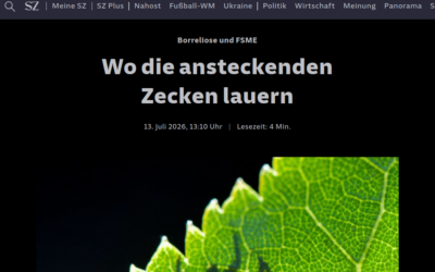
In the News: Monid Habitrack Featured in Süddeutsche Zeitung
Süddeutsche Zeitung recently covered our Monid Habitrack project, and we're happy to share it. The article follows the research team at work in the Oberpfalz, where our drones map vegetation and surface temperature while ticks are collected on the ground and tested...

EO4CAM PhD Students Present their Research at the GeoSeries Colloquium
On July 9, 2026, Daniel Gruschwitz and Sonja Maas from the Earth Observation Research Cluster (EORC) presented their current research in EO4CAM at the GeoSeries - Research Colloquium of the Institute of Geography and Geology, University of Würzburg, chaired by Prof....
We’re proud to be part of Space Days Würzburg 2026
We're happy that we are officially joining the Space Days Würzburg, from October 9th to 10th, 2026. The event brings together astronomy, informatics, and space science for two days, and we contribute Earth observation. Because studying space isn't just about looking...

A reply to the Programming Hero Syndrome post
A while back there was a post about the "Programming Hero Syndrome." This is a small extension to it, from a female perspective to provide a different view. When I started EAGLE, in those first weeks and months, I'd join internship talks or MSc defenses, listen to...

SUCCESSFUL MSC DEFENSE: Evaluating Surface Urban Heat Islands in Bavarian Cities through a Multi-Variable Analysis
On July 7, 2026, Farimah Abdolzadeh successfully defended her Master's thesis at the Earth Observation Research Cluster (EORC), University of Würzburg. Her research explored one of the central questions in urban climate science: which factors shape land...

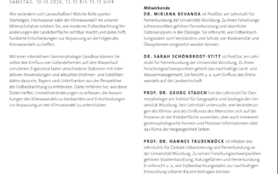
Getting Ready for 25 + 10
Next week's the big one. Twenty five years of EORC and ten years of EAGLE, all in one event, and we're expecting around 250 people through the door. Sabine Oppmann's been leading the prep meetings, and we've split things into clear teams: setup, catering, AV and...