A remote sensing and GIS training for professional development aid staff members was conducted last month. Within 5 days the participants learned the basics of spatial data handling, creating maps, acquiring remote sensing data and earth observation products up to doing first steps in GoogleEarthEngine. The practical desktop exercises were done using QGIS and its powerful expression functions and geometry generators. Despite the challenging situation did we receive quite positive feedback about our virtual training but of course we are looking forward to do in-person trainings again once the are allowed.
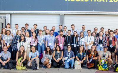
EORC Staff and EAGLE Students at ESA Living Planet Symposium 2025
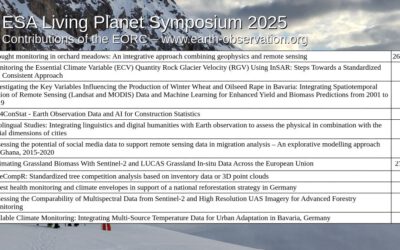
This week, our EORC team and EAGLE MSc students are joining the global Earth observation community at the ESA Living Planet Symposium (LPS) 2025 — one of the most important gatherings for Earth system scientists, remote sensing experts, and space agencies worldwide....