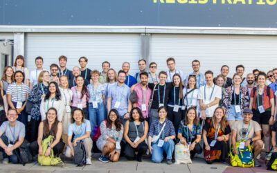
Over the past three days, staff of the EORC joined Germany’s “National Forum for Remote Sensing and Copernicus” taking place in Berlin. Hosted by the Federal Ministry for Digital and Transport (BMDV), experts from public authorities, industry and science met in the capital to discuss how our European Earth observation system is being used to benefit a wide range of areas.
The second conference day was opened with a keynote by our professor Hannes Taubenböck on the topic “Copernicus for society – how and where we (want to) live”. He outlined the built environment’s impact on society and how the proficient analysis of satellite imagery can be used to assess it at scale. His presentation was followed by a panel discussion in which Hannes was joined by representatives of municipal and federal authorities as well as industry and science to discuss how Copernicus supports climate adaptation strategies.
One of the conference sessions showcased “IF-Bund”, a framework for the innovative use of remote sensing in the federal administration. The session was moderated by our guest lecturer Dr. Monika Gähler from DLR. Each of the three success stories was presented jointly by a representative from the respective federal agency and a scientist from the DLR. Together with Klara Schönenberger from the Federal Statistics Office (StBA), our PhD student Dorothee Stiller presented her work on how remote sensing data can be utilised for census purposes through the use of artificial intelligence. Perspectively, the developed methodologies are due to be used in Germany’s 2031 survey of its population. In another contribution, Antonia Milbert from the Federal Institute for Research on Building, Urban Affairs and Spatial Development (BBSR) and Hannes Taubenböck turned to the question “How urban is Germany?”, showing that based on their analysis utilising remote sensing and population data this value is lower than the often-quoted 80%, depending the individual definition of urbanity.
The event’s poster exhibition saw a contribution from the EORC’s datacube team (eo2cube), in which our staff member Christoph Friedrich explained the architecture of their data processing and provision system. Utilising synergies with the DLR’s terrabyte platform, it enables researchers and end users to benefit from Earth observation data, for example in the context of precision agriculture.
In summary, the National Forum was a highly interesting event providing excellent opportunities to discuss and exchange with many stakeholders from various fields, where it is especially helpful in bridging science to industry and government authorities. We are looking forward to the next edition!
![]()